
Visit my new site velotrope.org for better and more up-to-date content. Thanks!
SUMMARY

A leisurely ride from Brooklyn to Westchester County that spans three boroughs and includes a pit stop at a delicious craft brewery, the ride to Tarrytown is one of my favorites.
This ride is also a great introduction to points north of the city along the east bank of the Hudson River. Any rides you might do, for example, up to Peekskill, Poughkeepsie, or Albany can all follow this basic route in the beginning. The journey has no serious obstacles and only takes about four hours to complete at a moderate pace. Riders in a hurry can probably tackle the distance in closer to three hours.
The main road that cuts through Tarrytown is U.S. 9, also known as Broadway. This is the same Broadway that runs through the famous theater district in New York City. It traverses the length of Manhattan from Bowling Green to Inwood, and continues north through The Bronx and Westchester County. Broadway, by name, ends just north of Tarrytown where it becomes Albany Post Road. But U.S. 9 continues for about another 300 miles up to Lake Champlain and the U.S./Canadian border. In theory, if you have a thing for congestion and traffic lights, you could ride all the way to Tarrytown by just sticking to this one road. But a much more preferable route is the combined duo of the Hudson River Greenway and the Old Putnam/South County Trail.
Tracing the west side of Manhattan Island from Battery Park to Inwood, the Hudson River Greenway escorts you beneath the George Washington Bridge and to the northern tip of the borough. Crossing over the Harlem River via the Broadway Bridge, you roll through The Bronx neighborhoods of Marble Hill and Kingsbridge to Van Cortlandt Park. From here you can find the beginning of the South County Trail, a 50-mile stretch of nearly uninterrupted bike path that runs past Tarrytown and all the way to Putnam County.
If you can plan your ride to coincide with the open hours of its tasting room, I definitely recommend stopping by the Captain Lawrence Brewery for a glass of suds. The brewery is located in Elmsford, NY and just minutes from the South County Trail. And though the distance from Elmsford to Tarrytown is only a few miles, it goes without saying to leave the brewery in decent shape to complete the ride safely. You’ll have plenty of options for a drink and some grub near the Tarrytown train station.
Escaping Brooklyn
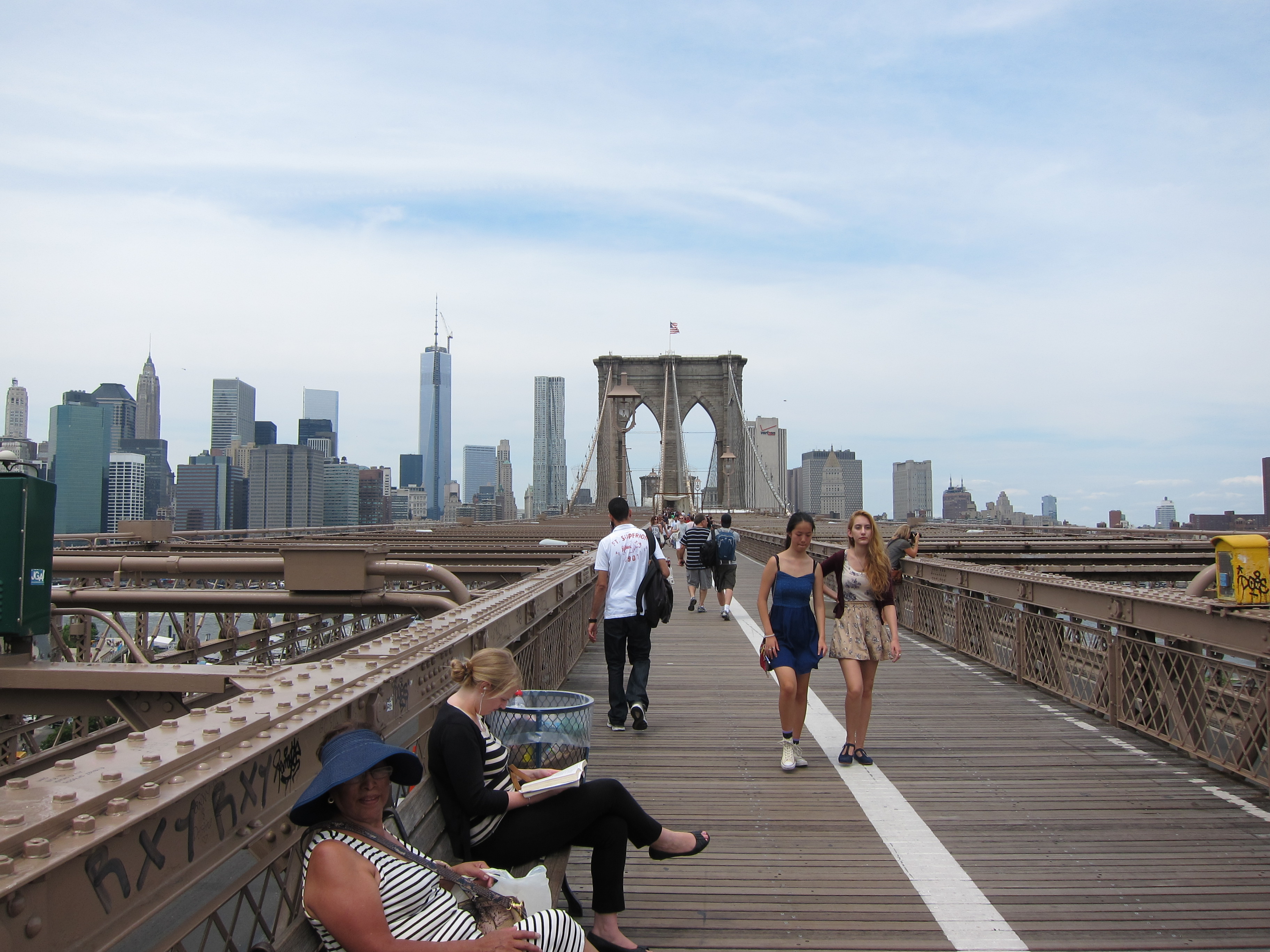
I work in Chelsea and commute by bike almost everyday. I alternate between the Manhattan and Brooklyn bridges for getting out of Brooklyn, depending mostly on the time of day and what kind of food I’m in the mood to eat before work. Personally, I like the Manhattan Bridge because there is far less tourist foot traffic and the bike lanes are wider. The trade-off is that I have to ride through congested Chinatown and SoHo to get over to the west side. However, the Brooklyn Bridge is an iconic landmark and offers easier access to the Hudson River Greenway. Therefore, let’s do our best not to hit the guy taking the perfect holiday photo of his family, and take the Brooklyn Bridge.
My ride begins at the SE corner of Prospect Park. I enter the park and ride north along East Lake Drive, more commonly known as the Prospect Park Loop.

Corner of Parkside & Ocean Ave
Going with the flow of traffic, I exit the Loop at Grand Army Plaza –

The Soldiers’ and Sailors’ Arch at Grand Army Plaza.
and shoot down Union Street to Fifth Avenue.

Looking down Union from Grand Army.
Turning right onto Fifth, I follow signs for the Brooklyn Bridge –
and make a left onto –
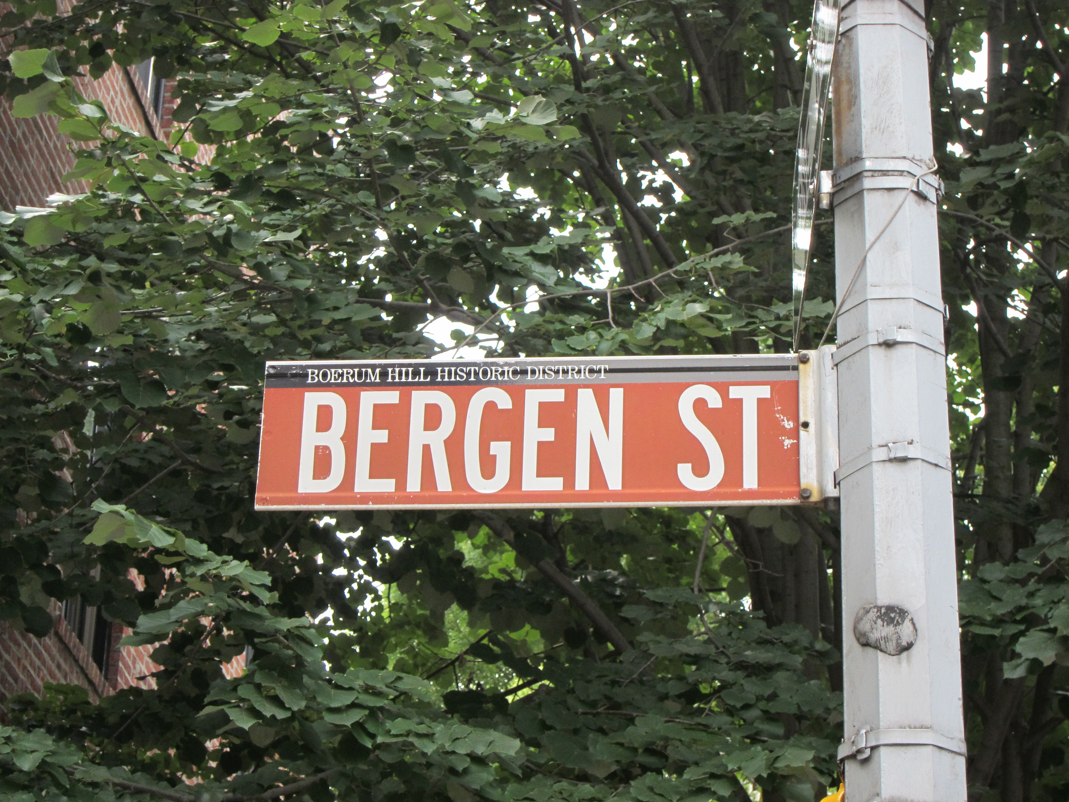
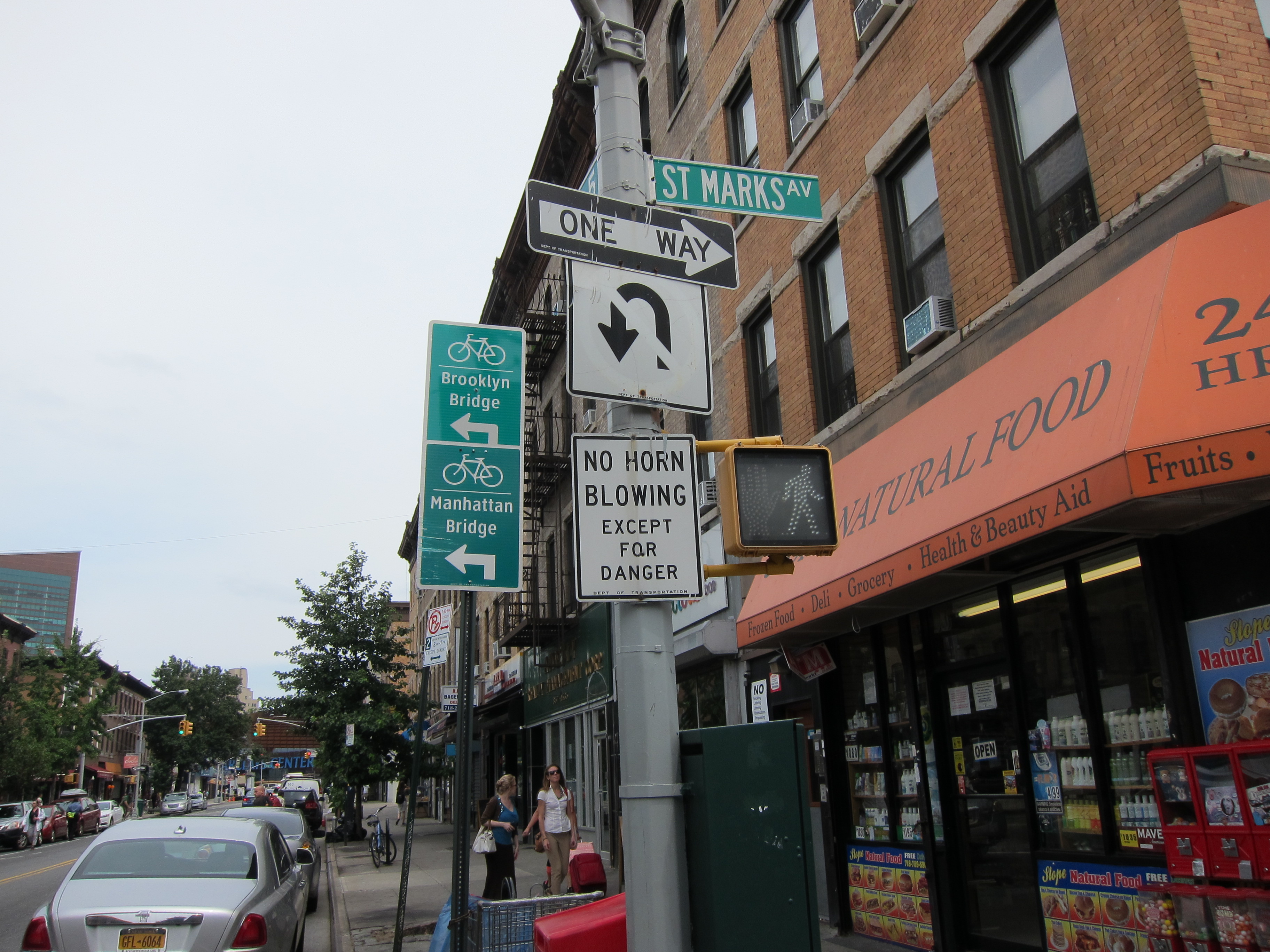
The Bergen Street bike lane cuts through the neighborhoods of Park Slope, Gowanus, and Carroll Gardens where I finally turn right onto –

Crossing over the busy intersection of Smith and Atlantic, I make a left onto Livingston just before hitting the Fulton Street Mall.

Livingston Street in Downtown Brooklyn.
A blink of the eyes and it’s a right turn onto –

Adams Street runs past the Shake Shack, the courthouses, the food carts and the business center of Downtown Brooklyn –

– before connecting with the bicycle entrance to the Brooklyn Bridge.

Manhattan and the Hudson River Greenway
Navigating carefully through the swarms of pedestrians and cyclists on the promenade, the Brooklyn Bridge ultimately spills out into City Hall Park and Manhattan’s Civic Center. Exercise caution when negotiating the left-hand turn from the bike path onto Centre Street, as cars and taxis flying off the bridge are not likely to consider you their number one concern as they merge onto the streets of Manhattan.

A cab entering Manhattan from the Brooklyn Bridge.

Turning left from the Brooklyn Bridge bike lane onto Centre Street.
For cutting across Lower Manhattan to the west side, a left onto –

– offers a straight shot. However, due to all the construction under way –

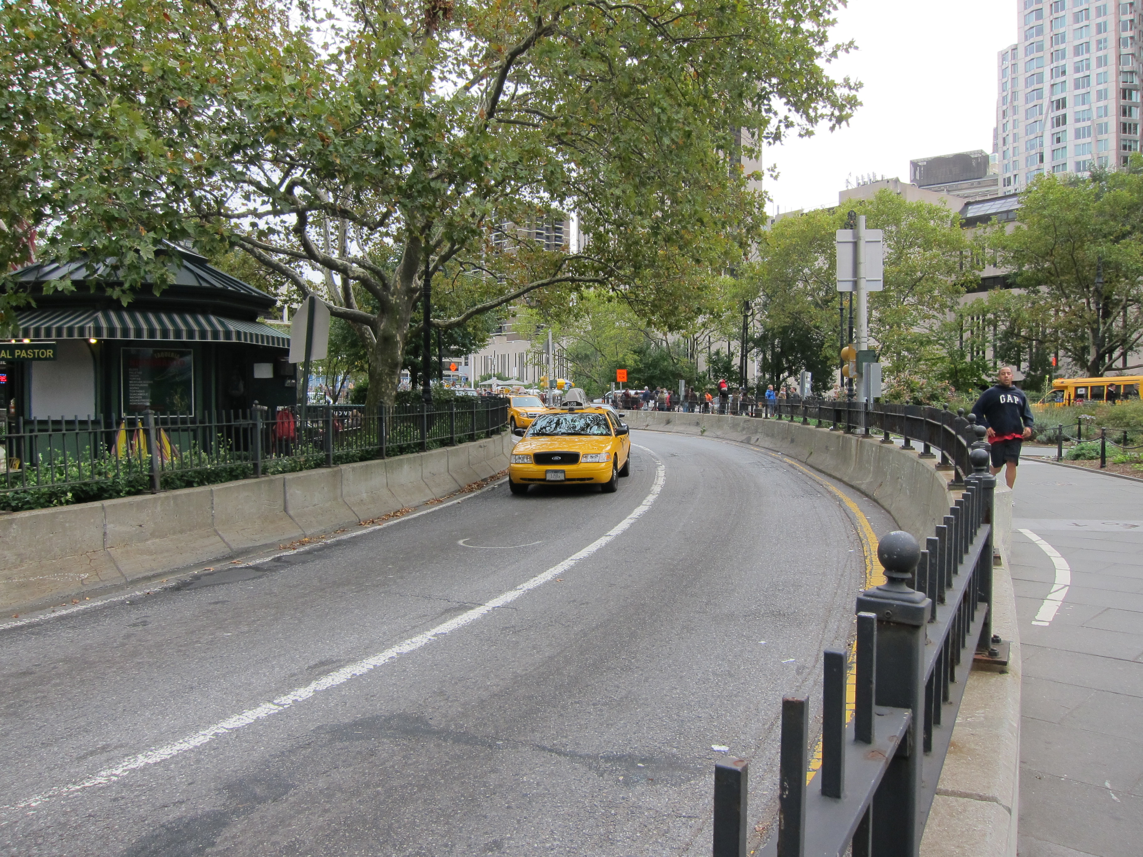
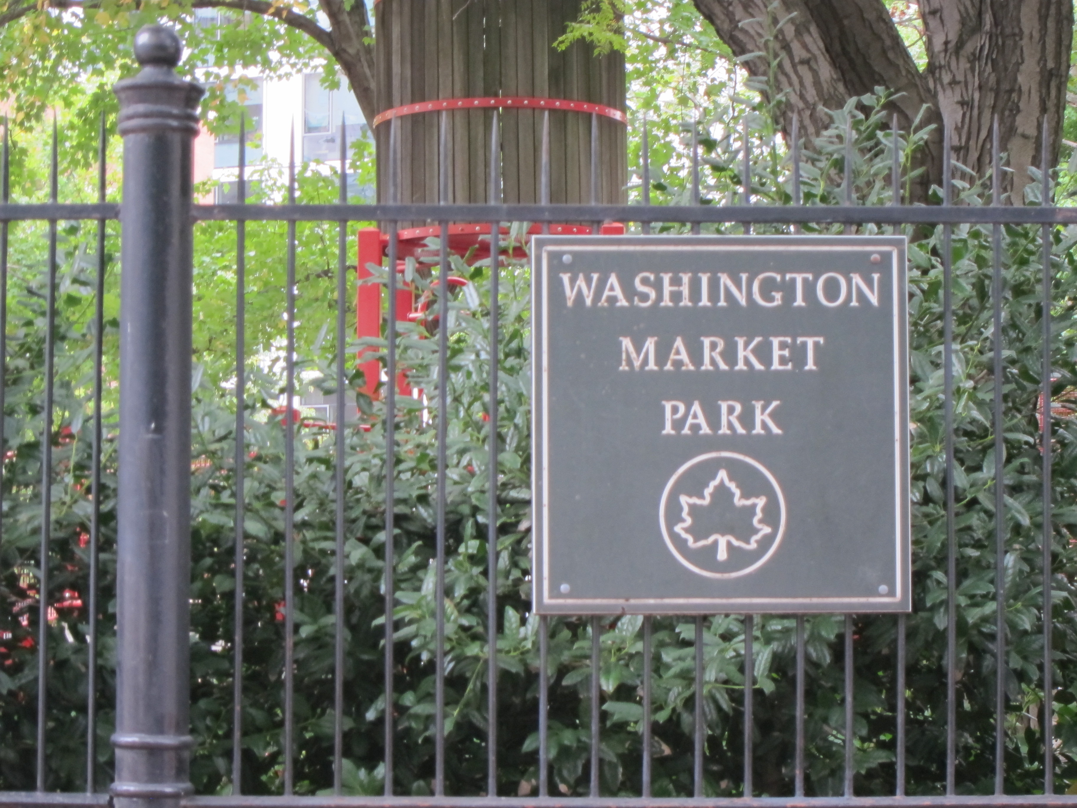
– one more past Chambers, is a much quieter and less bumpy alternative. At the end of Reade, turn left on –

at Washington Market Park.
Then it’s a quick right back onto –

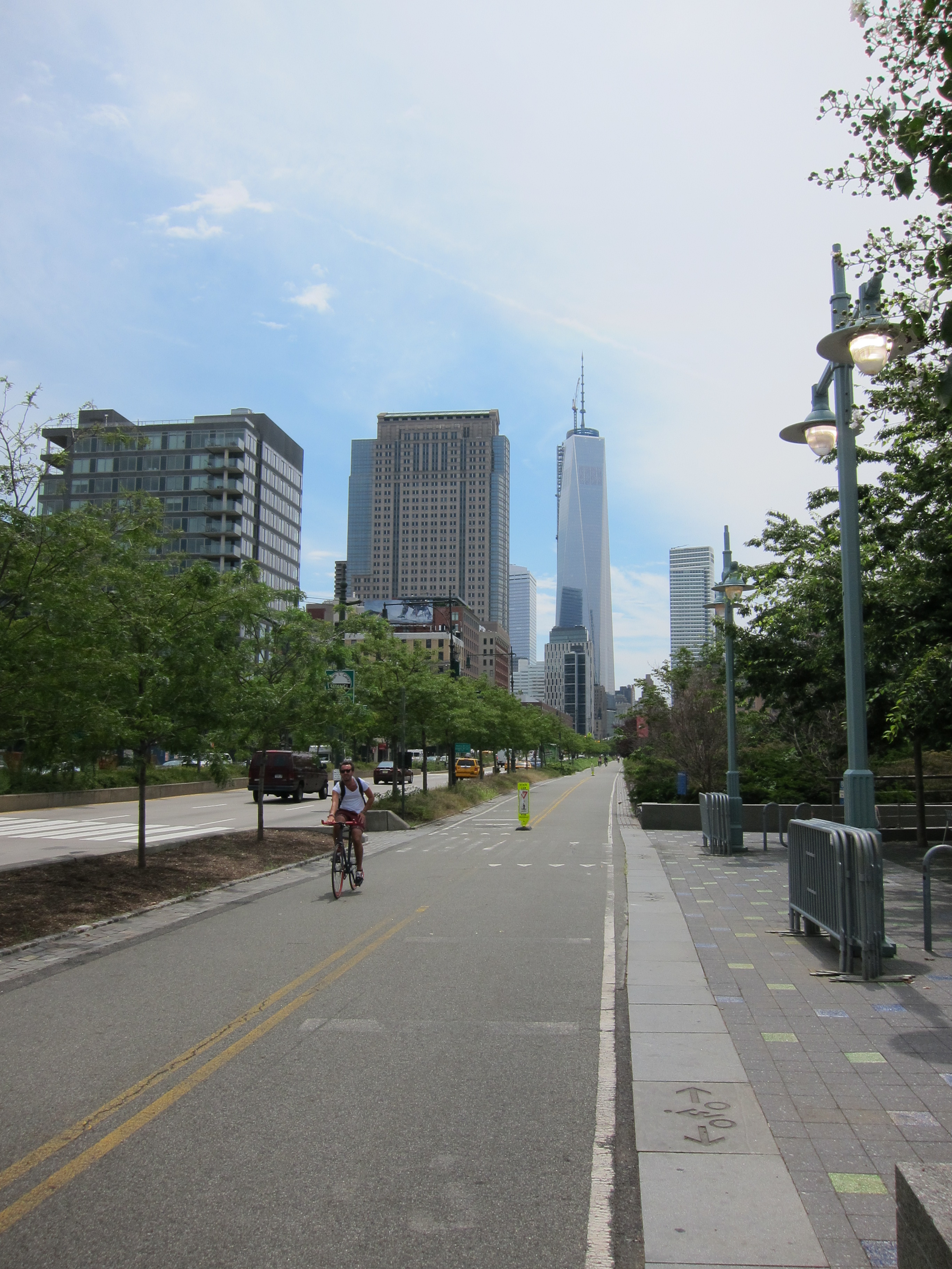
From here Chambers will lead you across the West Side Highway and onto the Hudson River Greenway bicycle path.


Entrance to the Hudson River Greenway at the end of Chambers Street.
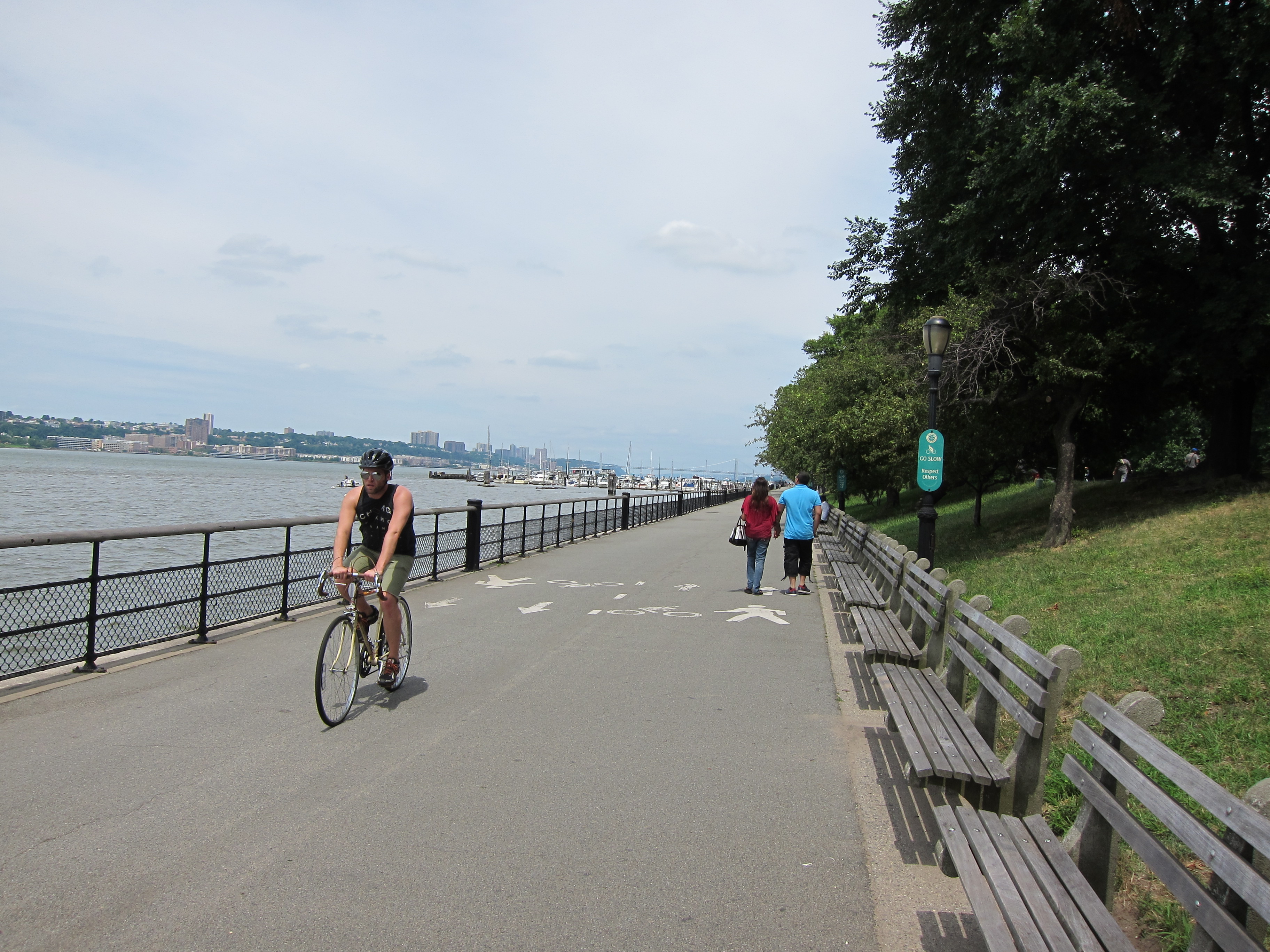
If you’re reading this blog, chances are you’ve probably ridden the Hudson River Greenway before. But just in case you haven’t, it must be said that this path is the cycling jewel of New York City. As mentioned earlier, this path, dedicated to cyclists and pedestrians alike, hugs the Hudson River from the southern to the northern tip of Manhattan. It is, in essence, separated from the rest of the city by the busy West Side Highway that runs beside it (middle finger slowly being extended to Robert Moses). The Greenway provides easy access to parks and plazas along the waterfront and on any given day you will find hordes of New Yorkers walking, jogging, rollerblading, cycling, picnicking, or otherwise taking advantage of its recreational offerings.
After crossing the West Side Highway, it’s a roughly 12-mile ride along the bike path to Dyckman Street where the path terminates in the northern Manhattan neighborhood of Inwood. As long as the river remains on your left-hand side you’re good to go.
Hudson Greenway looking south towards Lower Manhattan.

Jersey City across the river.
Hudson Greenway looking north. GW Bridge faint in the distance.
As I mentioned earlier, sections of the bike path are cut off from the adjoining communities by the highway, but as you ride north you will pass by a number of well-known neighborhoods that extend eastward into Manhattan. Some notable neighborhoods and attractions along the way:
- The West Village
- Chelsea and The High Line. Chelsea Piers along the water on your left.
- West 30th Street Heliport
- 39th Street Ferry Terminal which offers passenger service to Edgewater, Weehawken, Paulus Hook, Hoboken, and other points in NJ.
- The Intrepid Sea, Air and Space Museum (at the end of W. 46th)
- Upper West Side
- Morningside Heights
- Harlem
- Washington Heights
If you’re looking for a restroom or water fountain early on, the 39th Street Ferry Terminal has you covered.

39th Street Ferry Terminal
Or, better yet, if you can hold it for 100 more blocks, the Fairway in West Harlem is a good first stop.
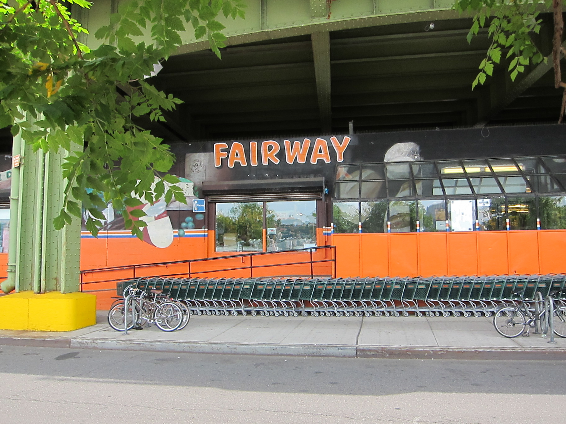
Adjacent to the bike path around 132nd Street, I’ll usually pop into Fairway for a bathroom break and a couple of pieces of fruit before continuing north.

At this point, there’s a small section of bike path that is closed until November 30th, 2013 because of construction.


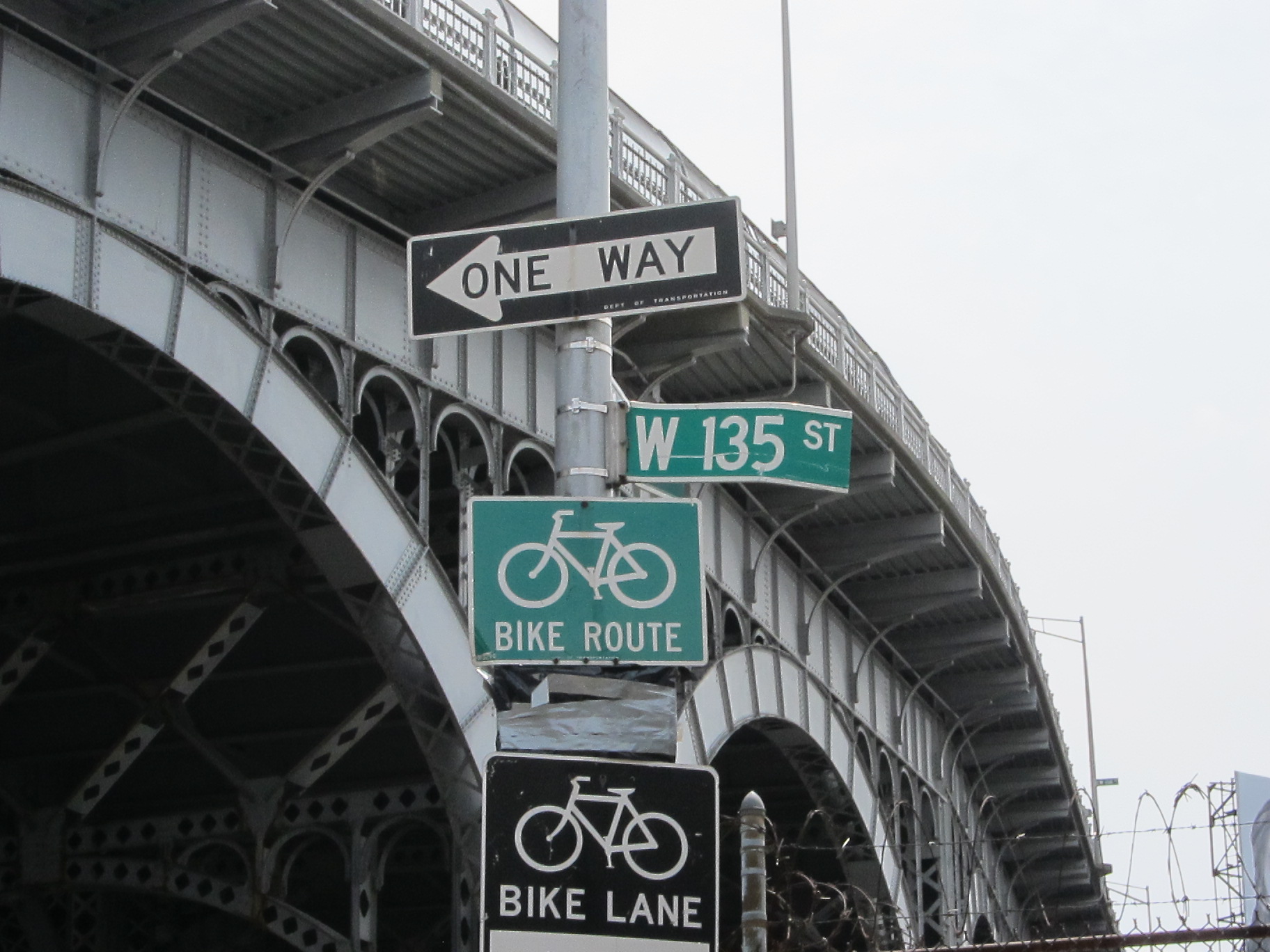
No big deal. Just follow the detour signs around the back of the Fairway and reconnect with the bike path on 135th Street.

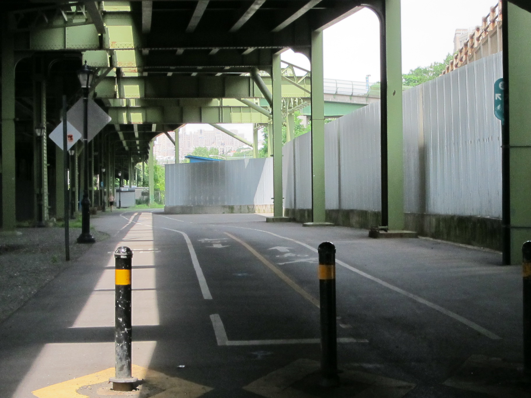
Continuation of Hudson bike path after Fairway.
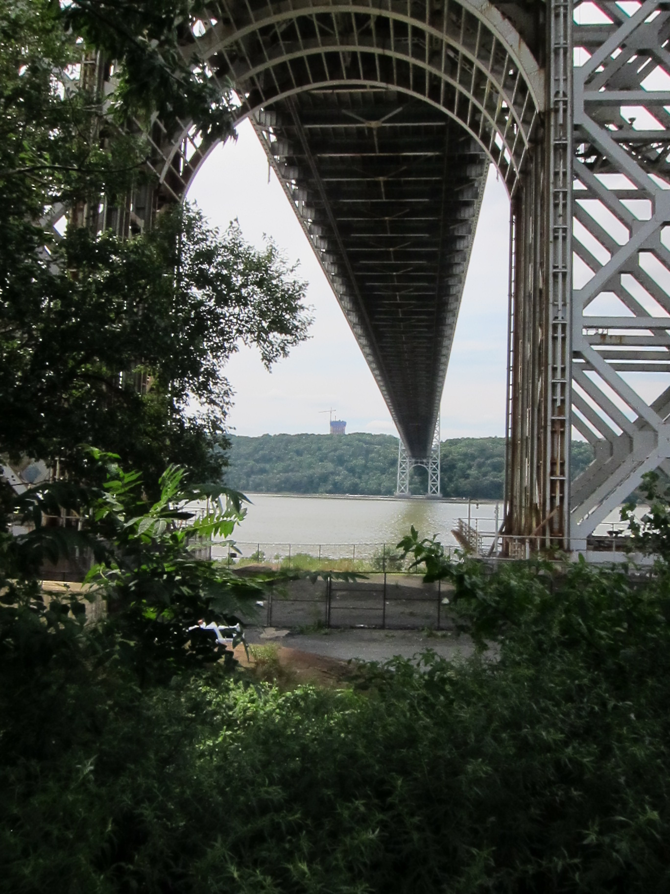
After a couple dozen more blocks, the George Washington Bridge comes into full view as the path rejoins the river.
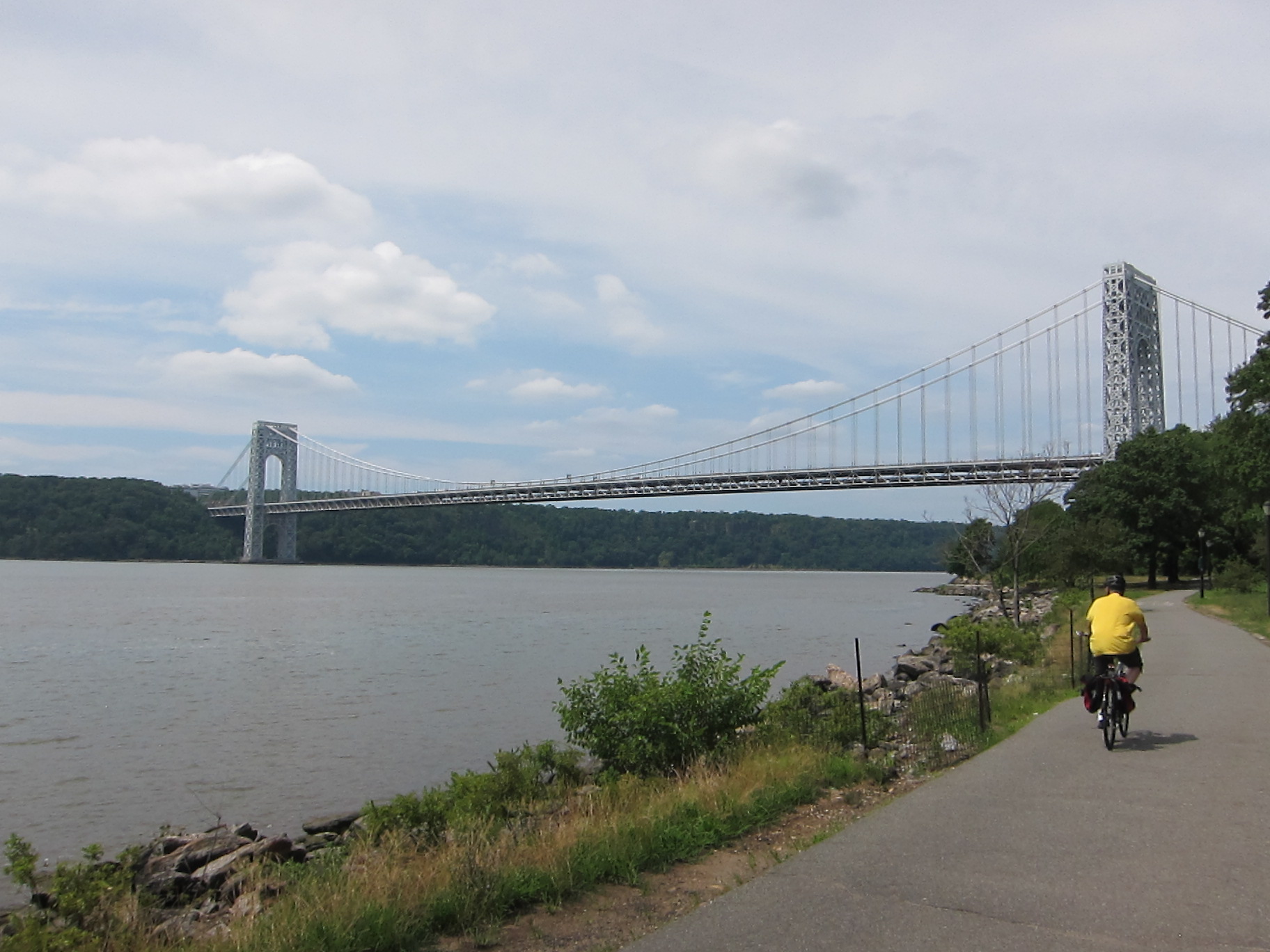
George Washington Bridge spanning the Hudson.
As you approach the base of the bridge, do yourself a favor and shift into a very low gear as there are a pair of short but significantly steep hills. Passing underneath the bridge, you’ll leave the bank of the river and climb up over the Metro North/Amtrak tracks and to the level of the Henry Hudson Parkway.


New Jersey Palisades
After climbing to the top of the hill, pass beneath the faded green pedestrian bridge and continue north along the path. For reference, this bridge will take you across the Henry Hudson Parkway and into Washington Heights where you can access the bike path across the George Washington Bridge into NJ.
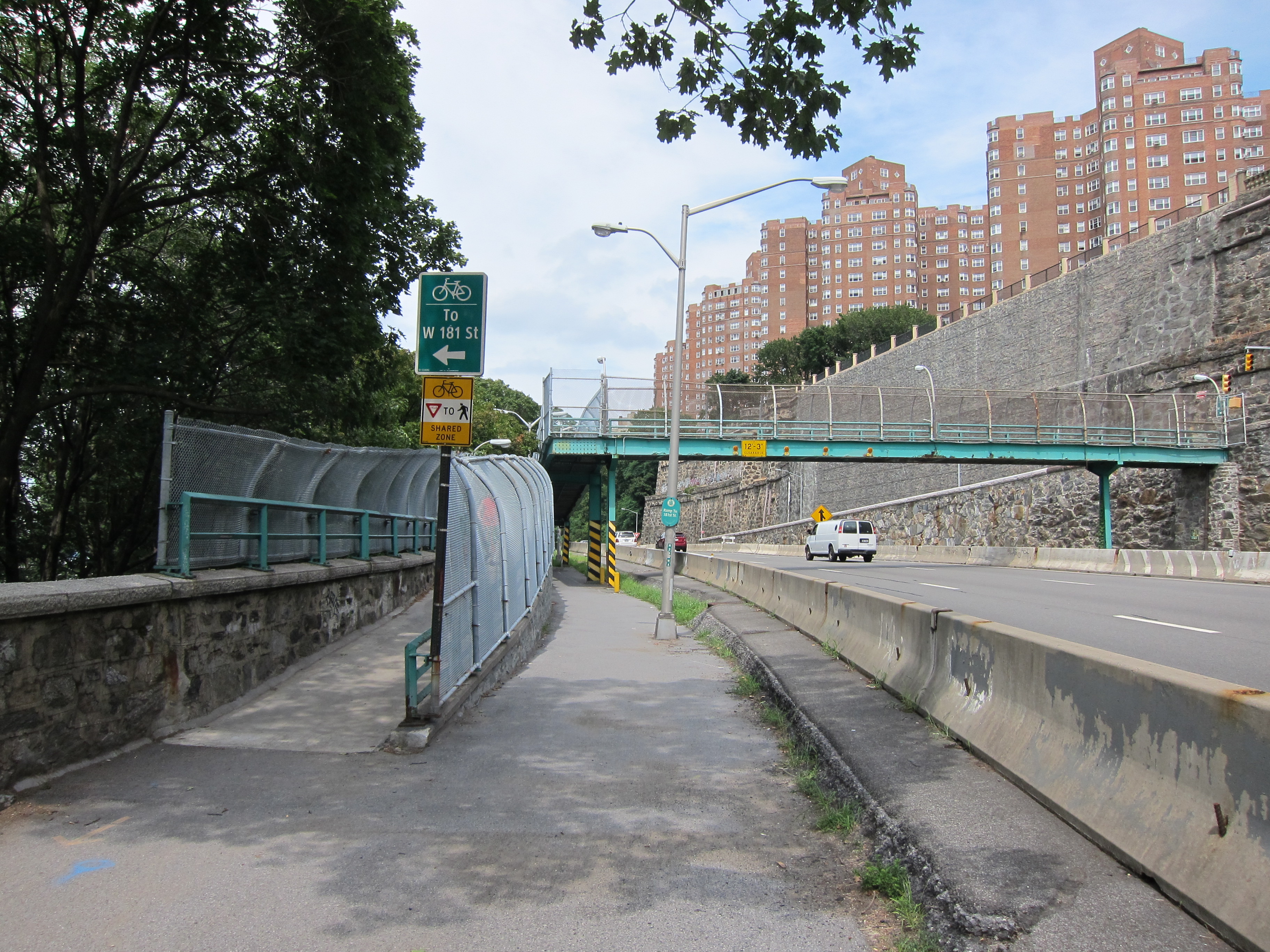

North of the GWB, the path runs parallel to the Henry Hudson Parkway.
The path runs for about a mile north, passing Fort Tryon Park on the right which houses The Cloisters. You’ll also pass a misplaced-looking structure on the left that resembles the ruins of some Roman palace left derelict to time. Inspiration Point Shelter does not provide the function that the last word in its name implies, but it still offers some sweeping views of the Hudson and the New Jersey Palisades across the river. For an interesting history on this structure, go here.


View from Inspiration Point Shelter.
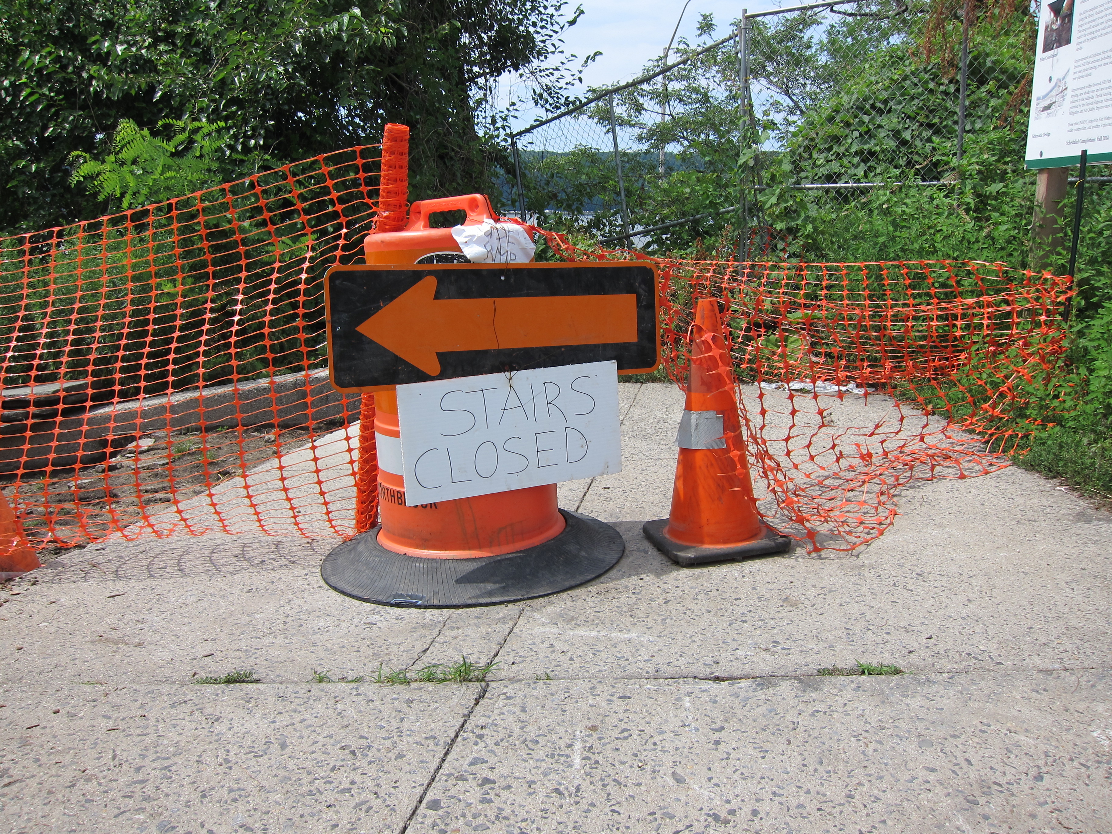
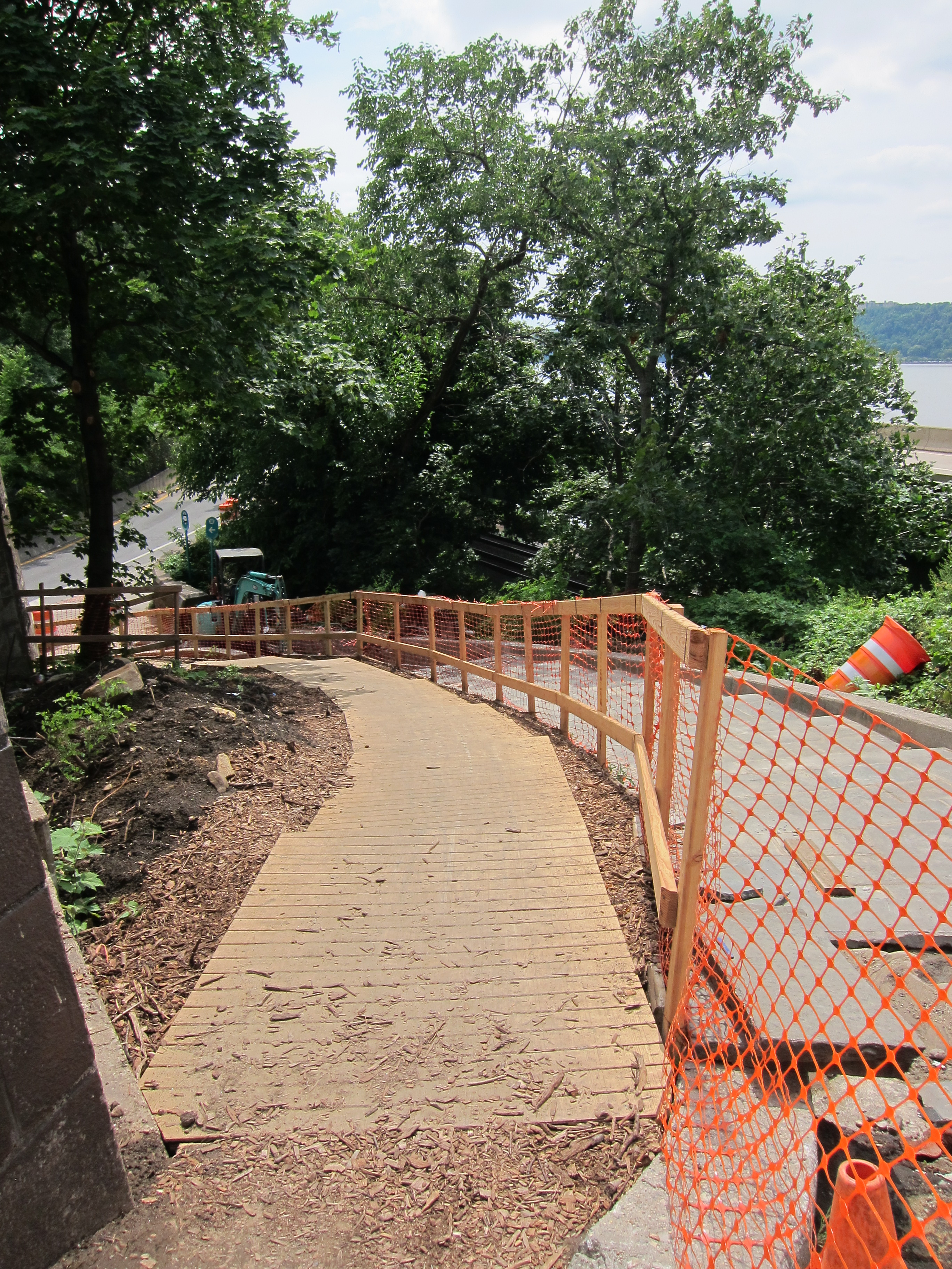
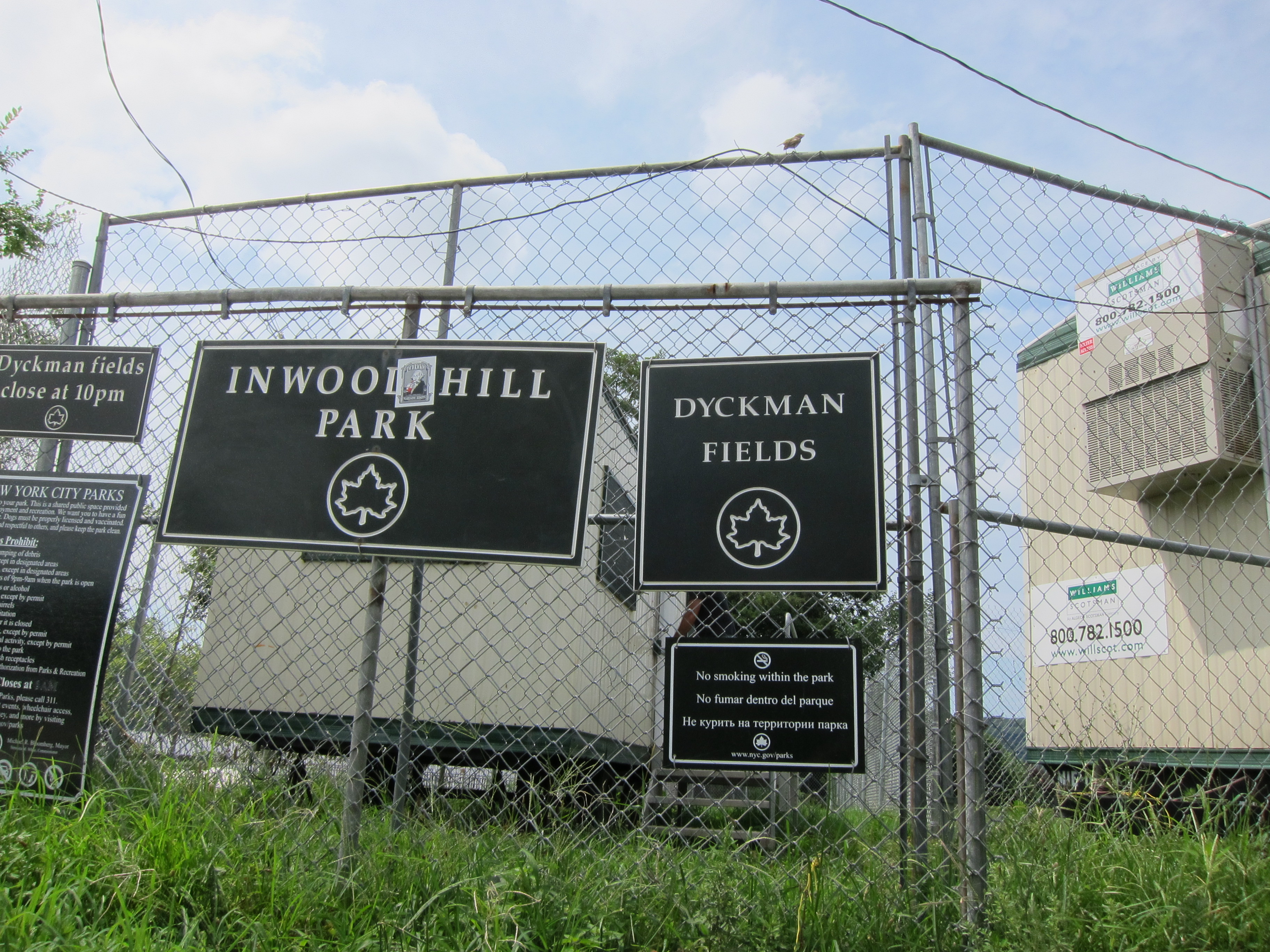
The end of the Henry Hudson Greenway is obvious as there is a chain link fence blocking you from going any further. There is also a staircase that descends down into the neighborhood of Inwood. At the time of this ride (July 24, 2013), the stairs were under construction and there was a makeshift set of steps laid atop a bed of wood chips.


At the bottom of the staircase, go left and find –

Ride down Staff to the bottom of the hill –

and meet –

West of the Major Deegan Expressway, there are two main methods of crossing from Manhattan to The Bronx. One is the Henry Hudson Bridge. Two is the Broadway Bridge. Here at the intersection of Dyckman & Staff you have the choice of going left towards the Henry Hudson Bridge or right towards the Broadway Bridge.
If you choose left, the road will lead you towards the river and the softball grounds of Dyckman Fields.

There’s a bike path that circles the park, but in order to access the Henry Hudson Bridge you have to carry your bike up and down these stairs.

Pain in the ass.
Then it’s another steep climb to the pedestrian entrance of the bridge. Unless you’re heading to Spuyten Duyvil or have your heart set on a ride that continues closer to the river (e.g. Warburton Avenue from Yonkers to Hastings is a good ride), I’d avoid this route and instead take a right on Dyckman Street.
*If you find yourself in need of supplies or repairs, Tread Bike Shop is close by on the corner of Dyckman & Seaman. It may be your last option for a while.

View of the Henry Hudson Bridge from Inwood.
After turning right on Dyckman, make a left on –

– and follow signs towards Van Cortlandt Park.

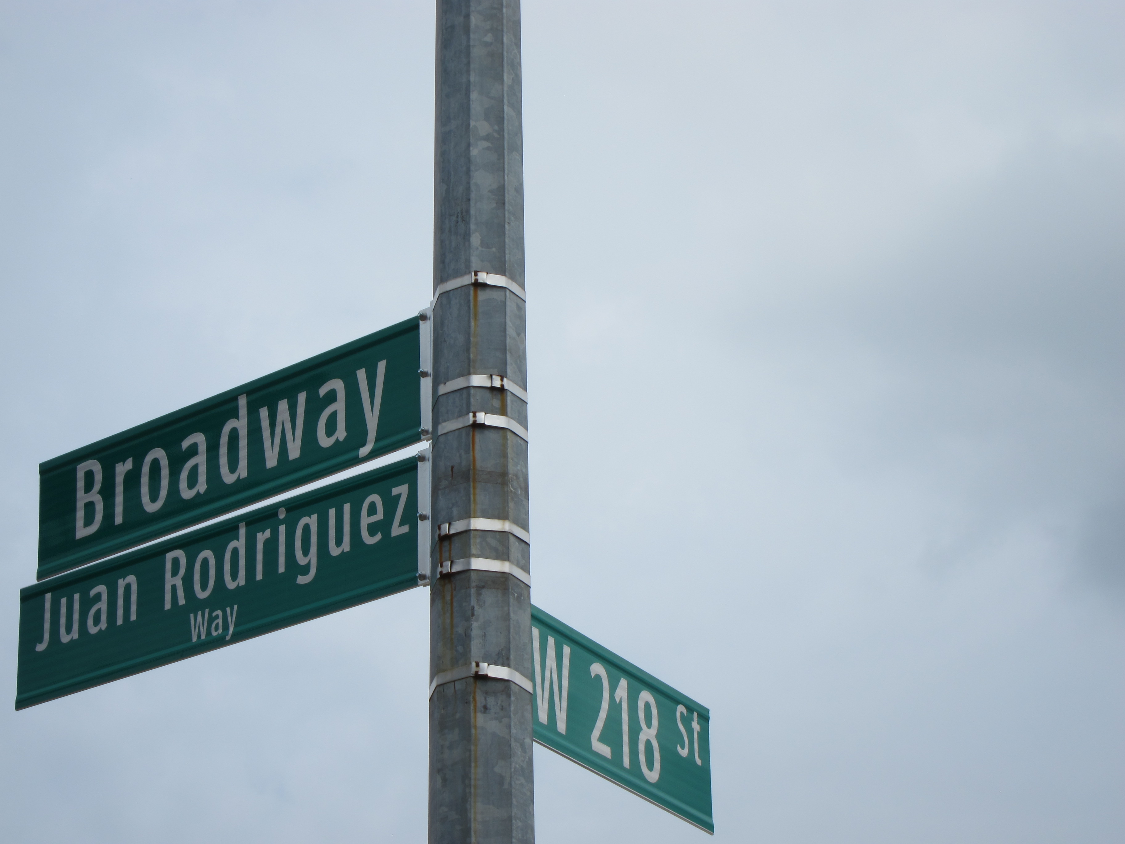
Follow Seaman until it hits the Columbia University athletic complex at –

Turn right onto 218th and then left onto –
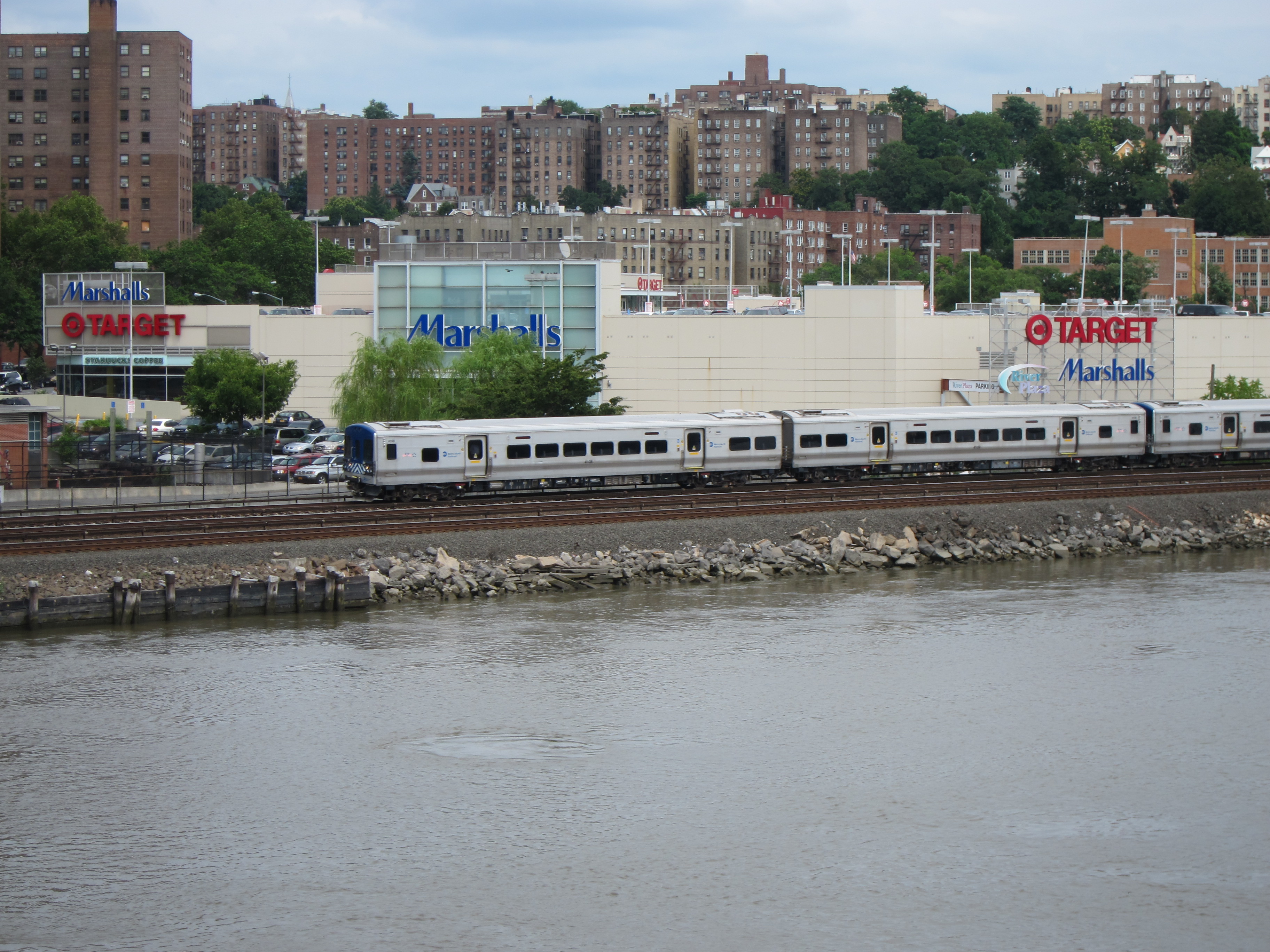
After just a few blocks, the Broadway Bridge will cross the Harlem River into The Bronx.

Broadway Bridge
Northbound Metro North railroad.
The Bronx
Broadway leads all the way to Van Cortlandt Park, but there’s a better route. Stay on Broadway for a few blocks once you reach The Bronx side of the Harlem River and turn left on –
There are a few twists and turns in order to avoid Broadway, but as long as you continue to follow the bicycle lane towards Van Cortlandt Park it’s a piece of cake. Make your next right onto –

Passing Marble Hill Playground on your right, turn left onto –

Then right onto –
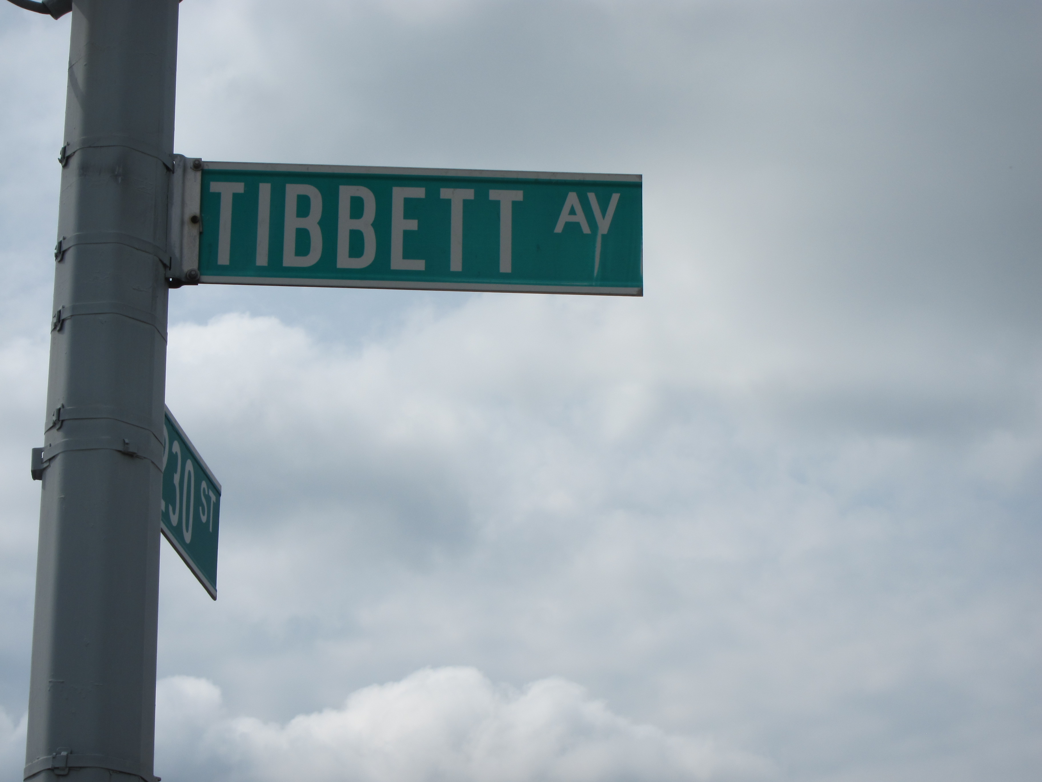
Follow Tibbet Ave through the working-class neighborhood of Kingsbridge and hang a left at Gaelic Park onto –
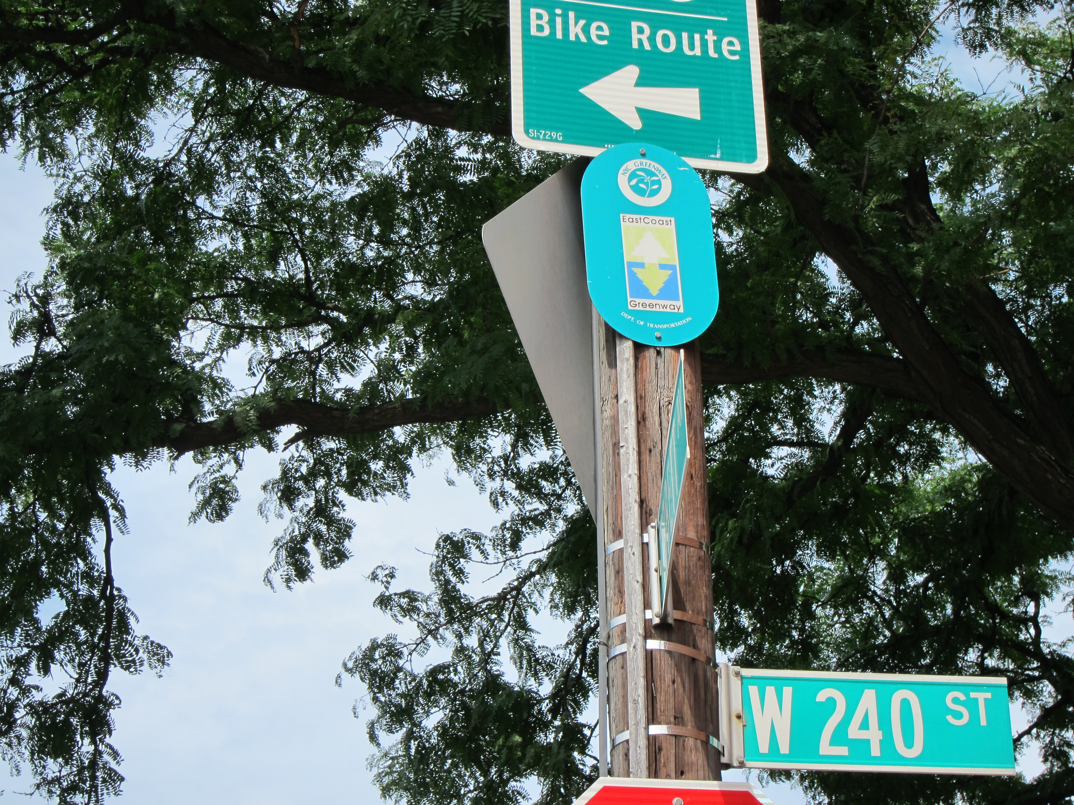
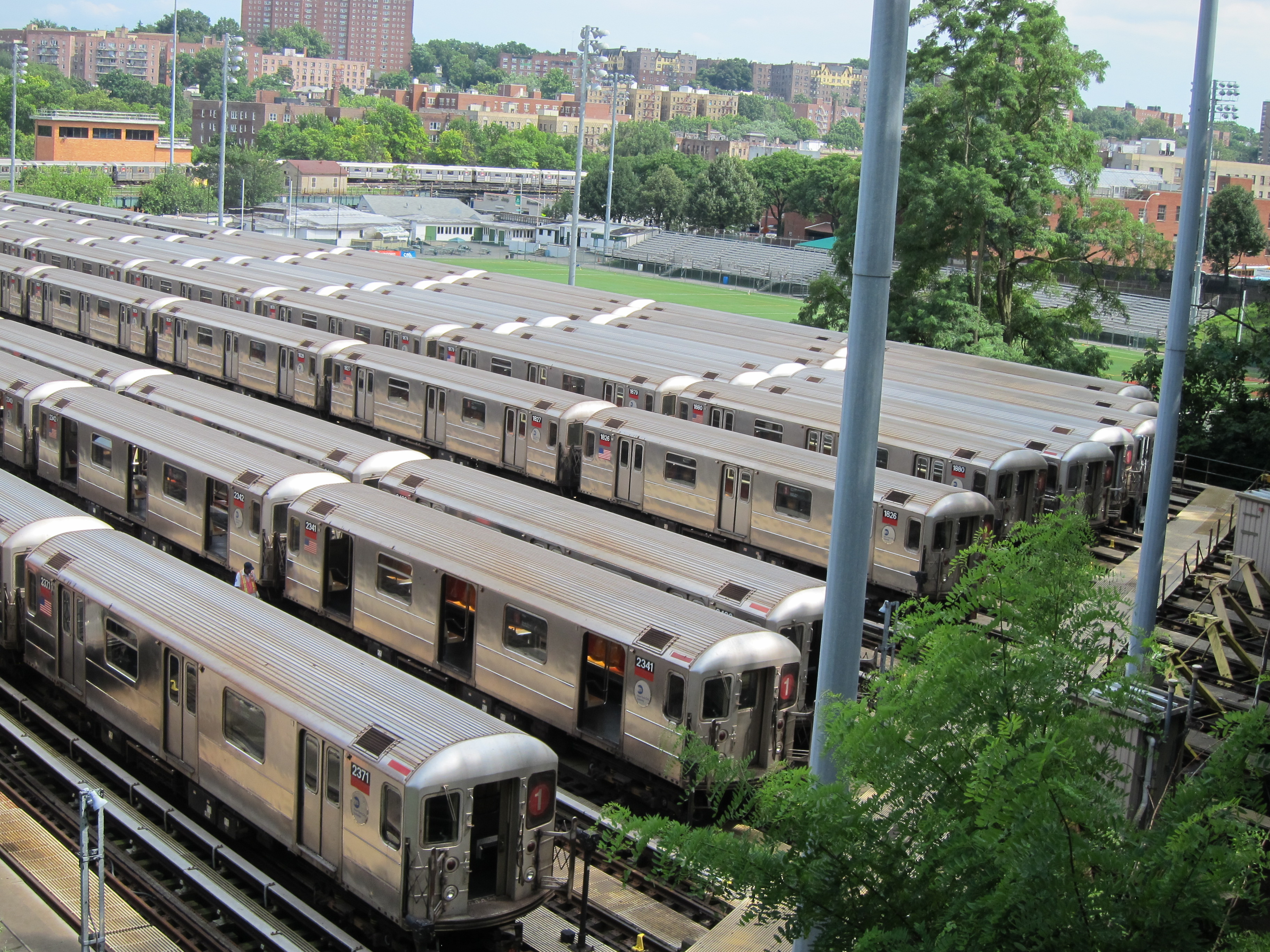
Climbing to the top of 240th, you’ll encounter a pedestrian path that bypasses a construction zone and overlooks an MTA graveyard full of 1 trains.

Look for the bike lane and follow Manhattan College Parkway down the hill to the right (it’s not really a parkway).
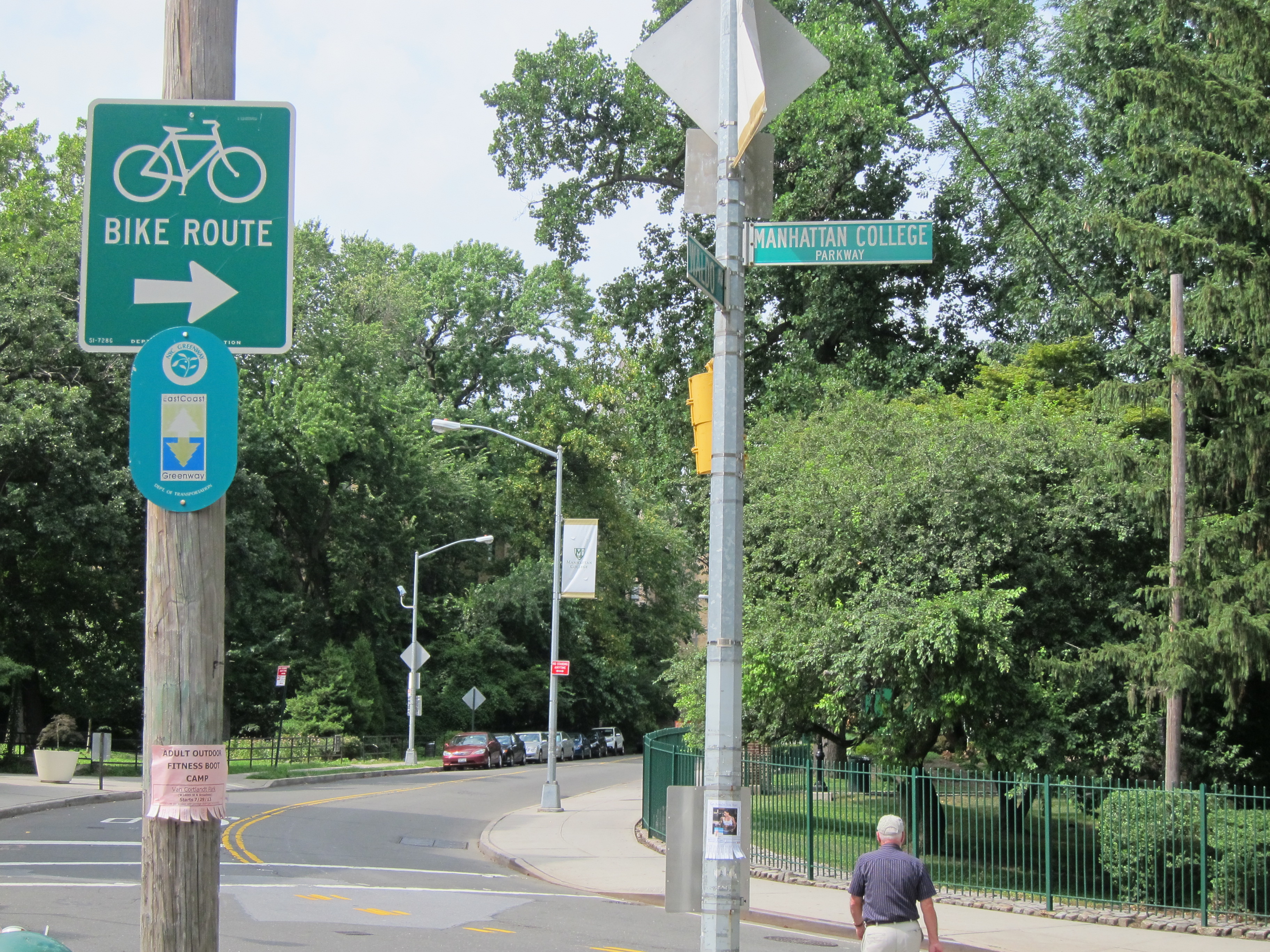
At the bottom of the hill you will be at the intersection of –
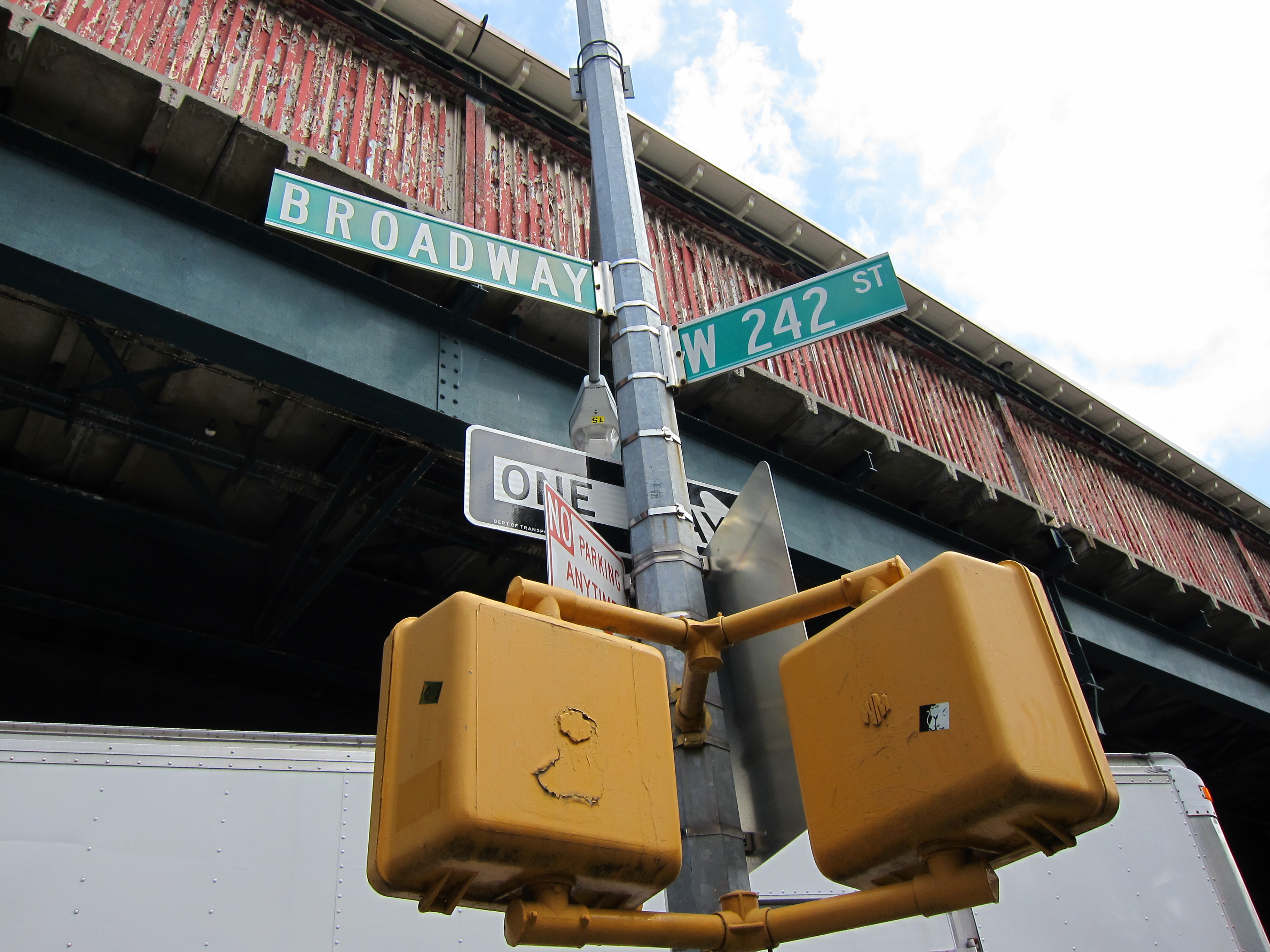
– and the much-awaited Van Cortlandt Park will be directly in front of you. All you have to do is cross Broadway. Congratulations. You have reached the end of New York City and the five boroughs (well not quite, but almost).
The 242nd Street Station is next to the park.

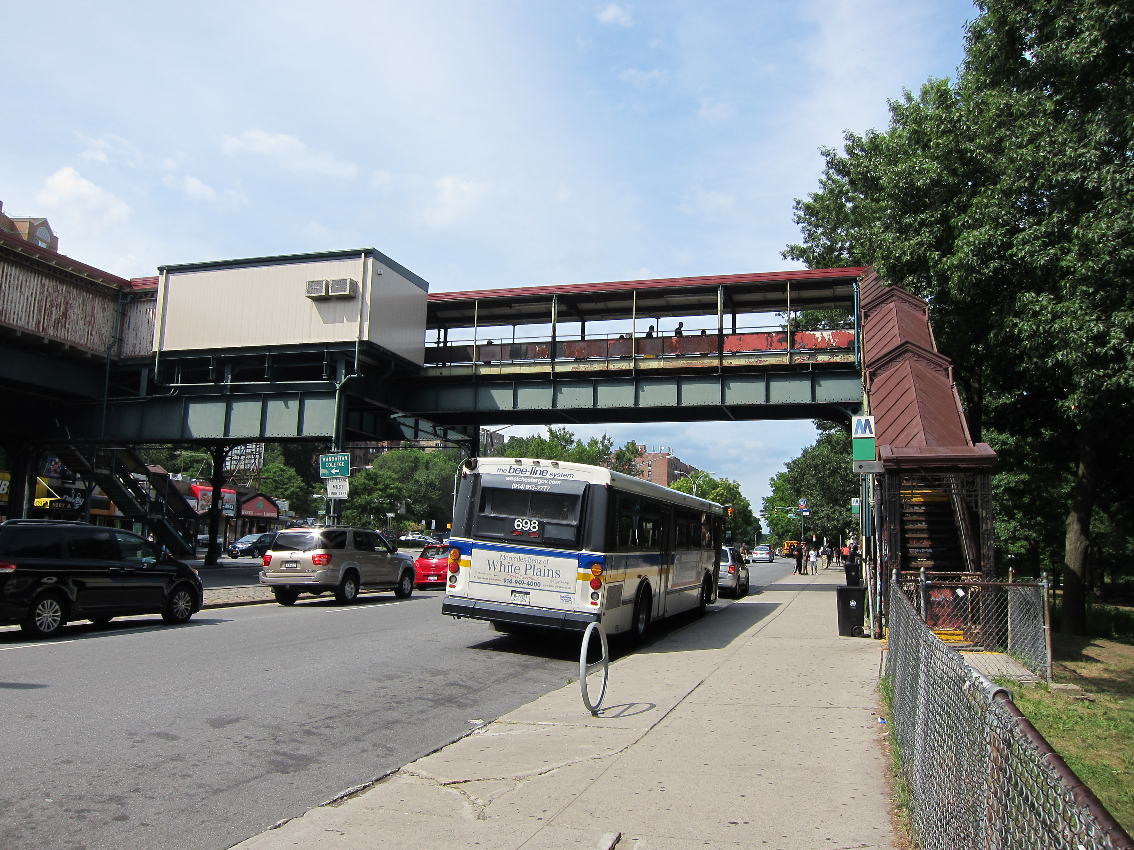
This is the end of the MTA subway line. If you’d like to celebrate, or simply stock up on provisions, I recommend the bodega on the corner. It may be a while before the next convenience store presents itself.
When you’re all stocked up and ready to go, follow the path into the park.
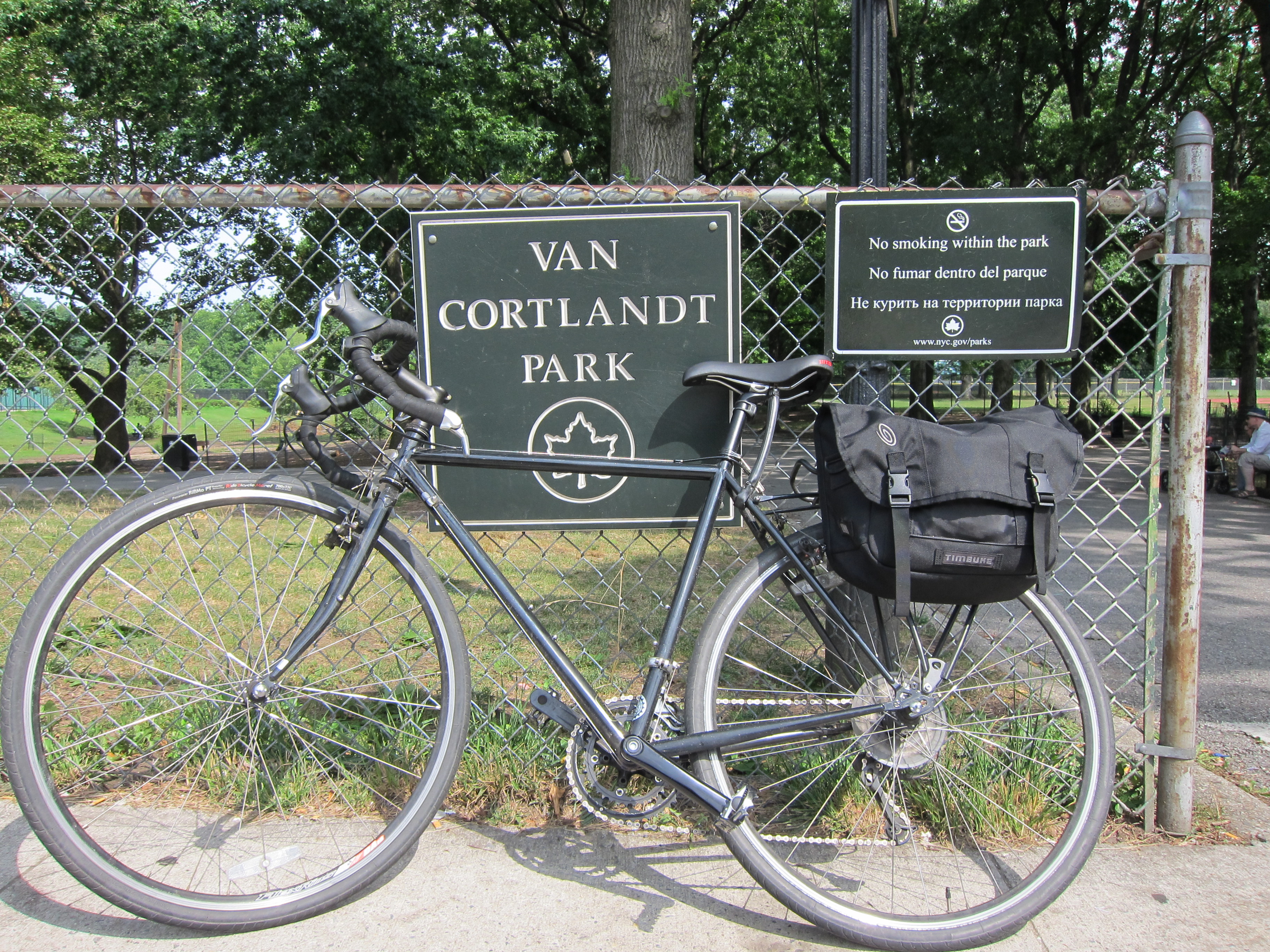

Entrance to Van Cortlandt Park.
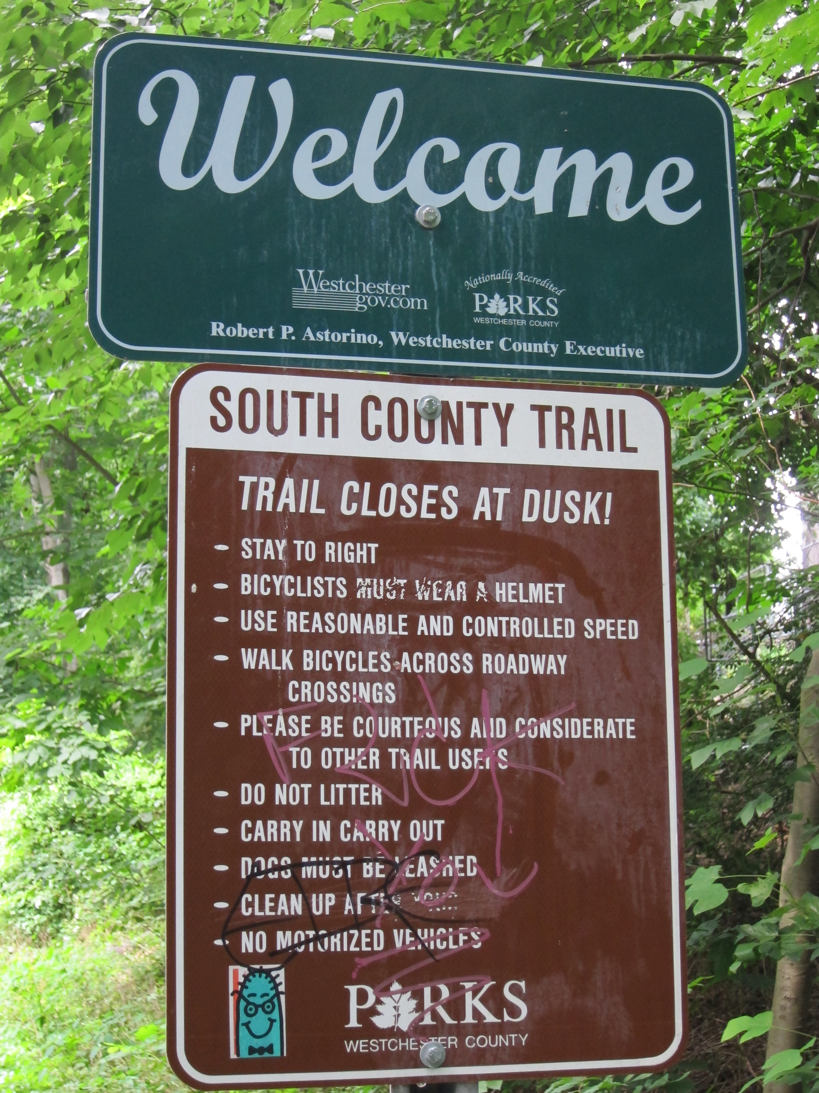
The Old Putnam/South County Trail
The Putnam Division of the New York Central Railroad was an old rail line that provided freight and passenger service between The Bronx and the town of Brewster in Putnam County. The “Old Put”, as it was referred to by its commuters, operated as a passenger line from 1881 to 1958. It made its final freight run in August 1982.
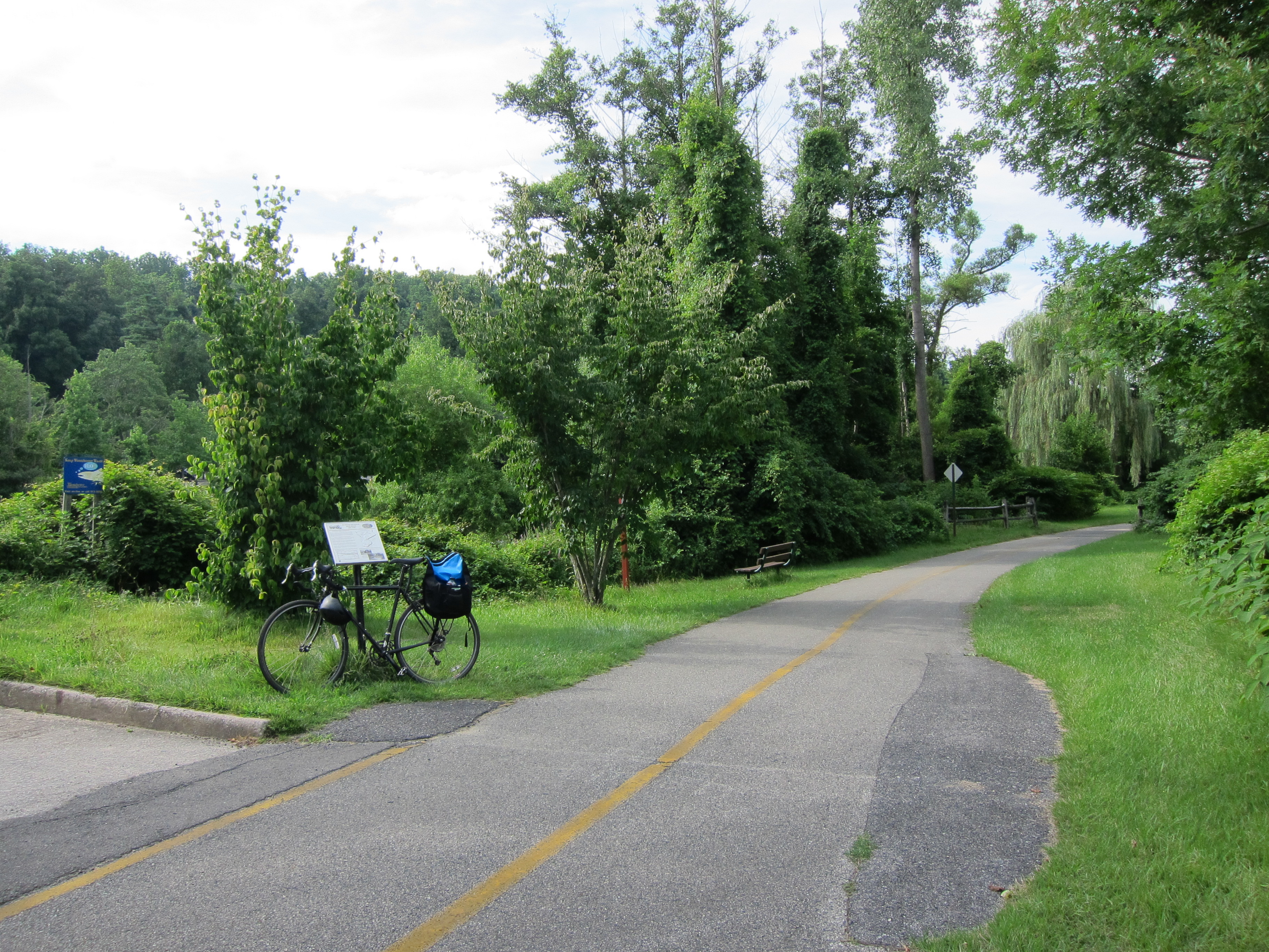
The Old Putnam Trail, or South County Trailway, is located on the right-of-way of the old Putnam line. The beginning of the trail can be found in Van Cortlandt Park. Finding it, however, is not the easiest task as there are many different trails crisscrossing throughout the park. The simplest way is this:
Once you cross Broadway, enter the park through the entrance near the subway steps and follow the paved bike path straight ahead, keeping the Van Cortlandt Swimming Pool on your left. After about 30 seconds, the path will fork. Keep to your left. After another 30 seconds or so, the paved path will run across a dirt patch and you will see a metallic blue overpass.

Go underneath the overpass and follow the path to your left.
For a visual explanation, watch this amazing video.
After turning left beneath the blue overpass, you will soon arrive at a squat, gray-brick building with white roof that looks just like this:

Follow the path around the building to the LEFT and you will be presented with this unassuming foot bridge:

Blue rails to match the blue overpass.
This is the beginning of the Old Putnam trail. When first searching for the entrance, I asked a park custodian where the trail was “that’d take you to Brewster.” He led me to the foot bridge, pointed straight ahead, and told me to “just keep on truckin’.” He wasn’t kidding. If you follow this trail all the way to its end, you’ll wind up near the CT border in Brewster, NY.
Just be sure that the lake is on your right. If it’s on your left, you’re on the wrong trail and likely headed towards Pelham Bay. Let us know how it is!

The Trail
The first 1.5 miles of this trail is hard-packed dirt peppered with the occasional stone, tree root, and railroad tie for good measure. The dirt may also become incredibly soft after a decent rainfall, which can make this section difficult (but not impossible) for a road bike with thin tires.

Railroad ties next to a mud puddle.

But if you’re able to handle the rocks, roots and mud, your perseverance will be rewarded. Not just with the occasional chipmunk scurrying across your path, but with eventual terra firma. Good old solid pavement for the rest of the ride.

In fact, when you reach pavement, you can now be assured that you are:
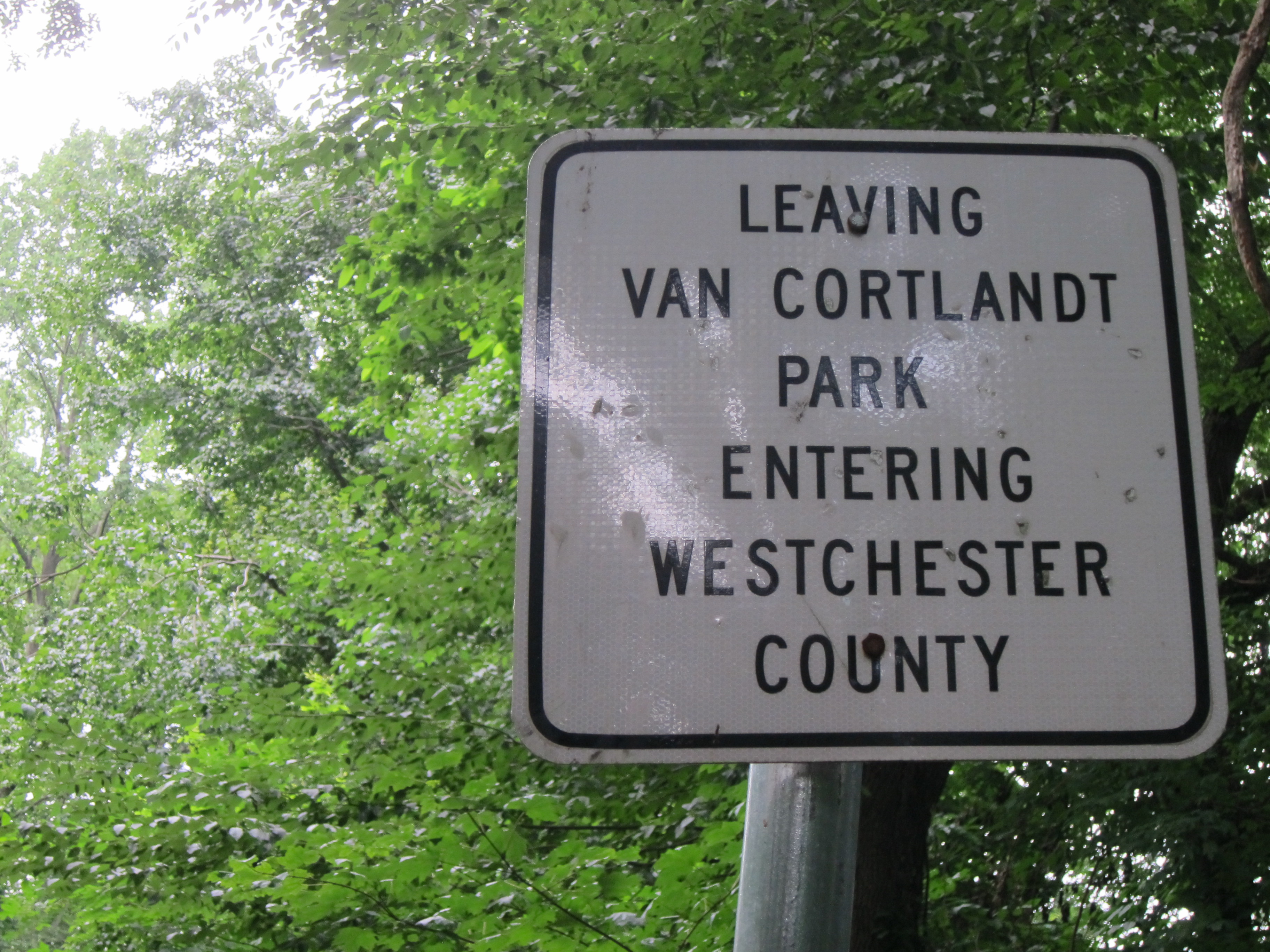
Yes. It’s official. You have now left behind the last of the boroughs and are now entering what we can arguably call “Upstate” New York.
Once you’re on the South County Trail, there’s nothing more to it than just sticking to the path. You’ll come across the occasional interrupting road, but the path’s continuation is always clear. Disregard any hand-written signs that are intended to confuse, such as this one at Mile Square Road:

The trail is clearly across the road. Not to the right as the sign would indicate.
You’ll be pedaling steady for the next hour as you traverse the first 10 miles of the path. There’s not much change in scenery as the trail mostly passes through clusters of familiar-looking woods. There is, however, the occasional neighborhood decorating the periphery and even a few private backyards that adjoin the trail.
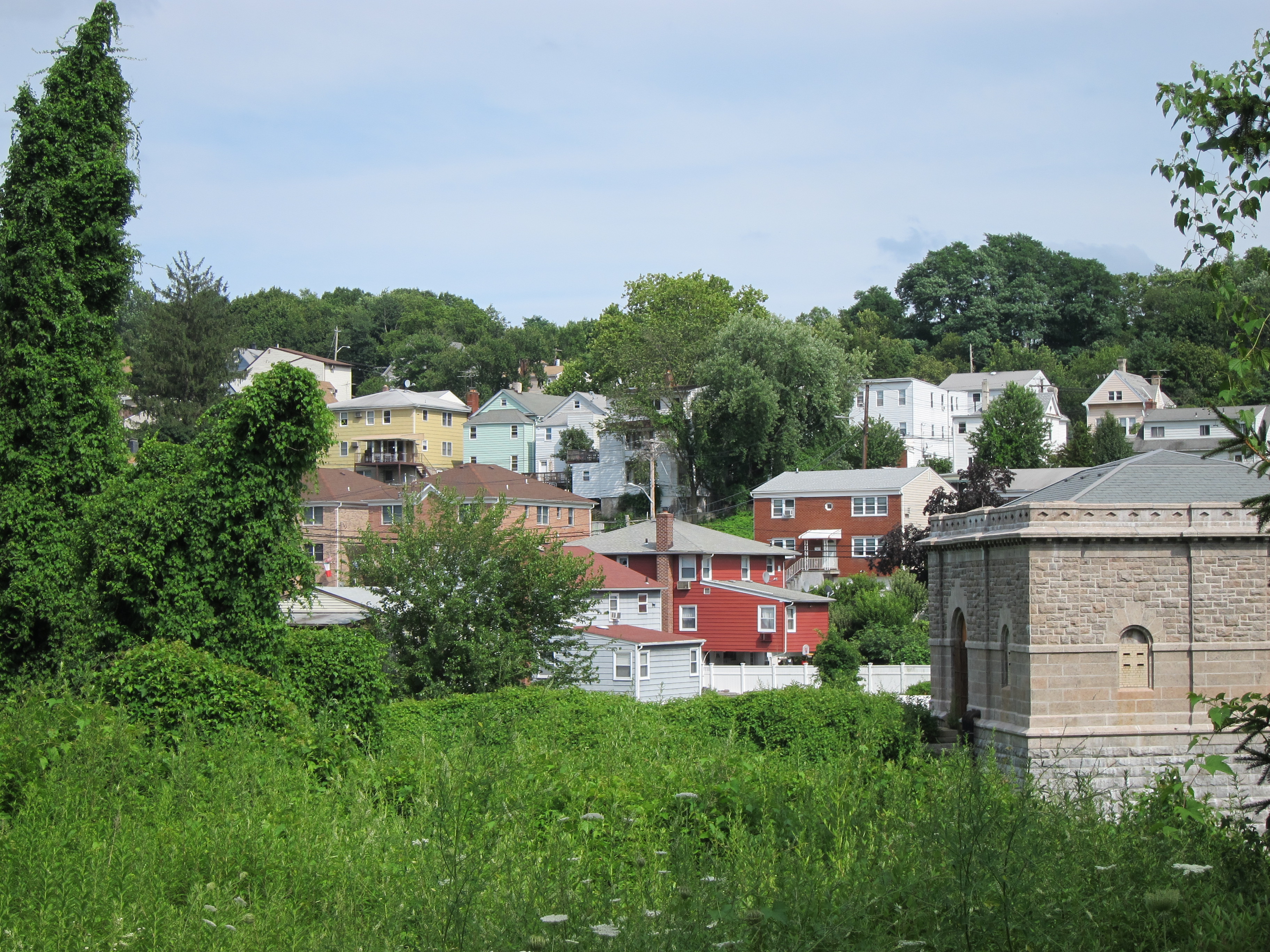
The Yonkers neighborhood of Dunwoodie, east of the trail.
My first rest stop along the South County comes at Woodlands Lake, just about 2.5 miles shy of Elmsford. You can’t miss the approach as you cross over a creek bridge and hear the rushing white noise of a small waterfall on your left. On the far side of the bridge you’ll find the lake.


Woodlands Lake
The fact that you will probably be hungry at this point is appropriate. Across the lake, and accessible by bike or foot, is the Great Irish Hunger Memorial of Westchester County. Unveiled in 2001, this memorial serves as a tribute to the millions of peasants who starved during the Irish Potato Famine (an Gorta Mór) and commemorates the Irish immigrants who settled in Westchester and built the railroads, dams, aqueducts, and other critical infrastructure that serves the county.

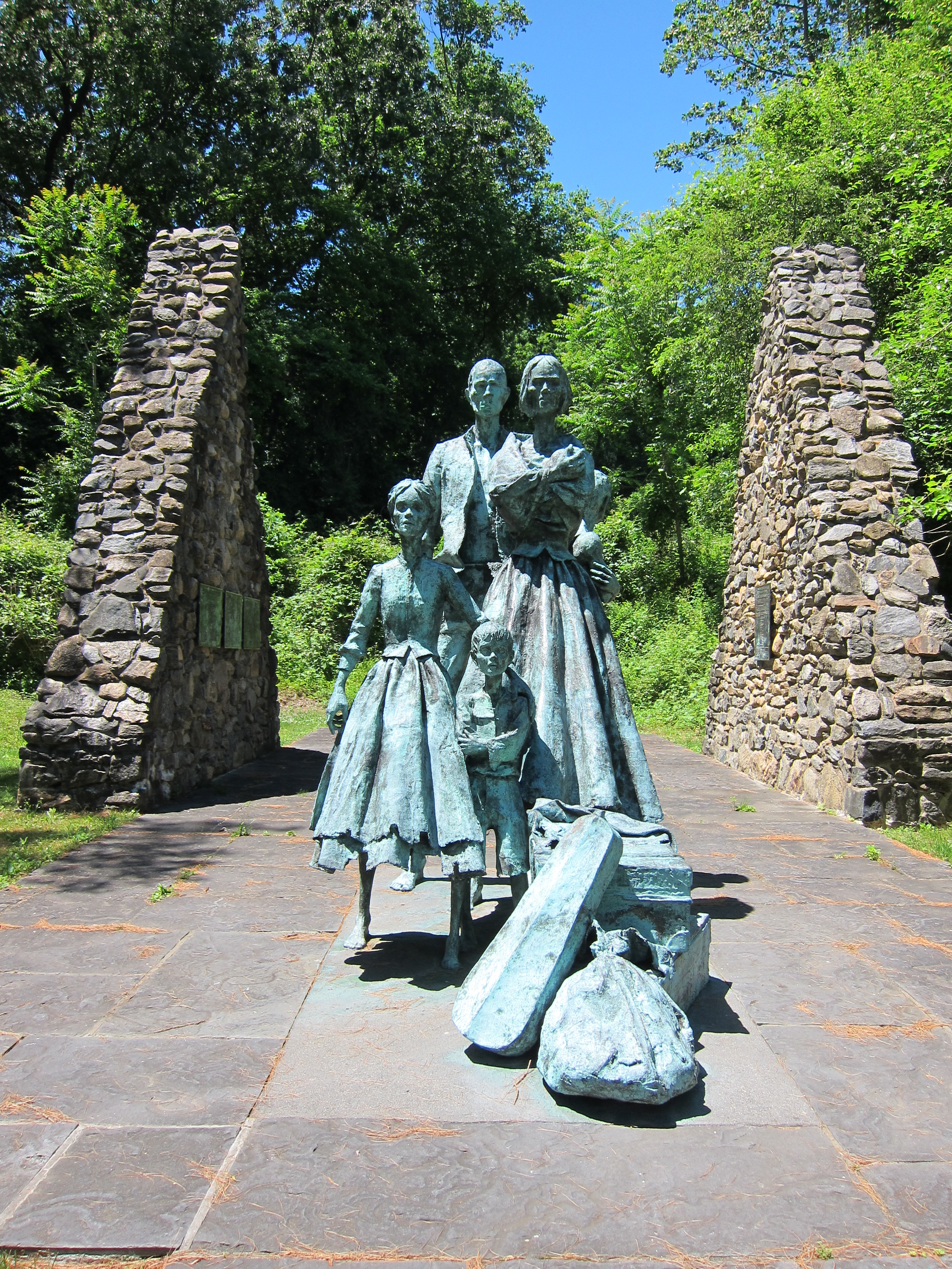
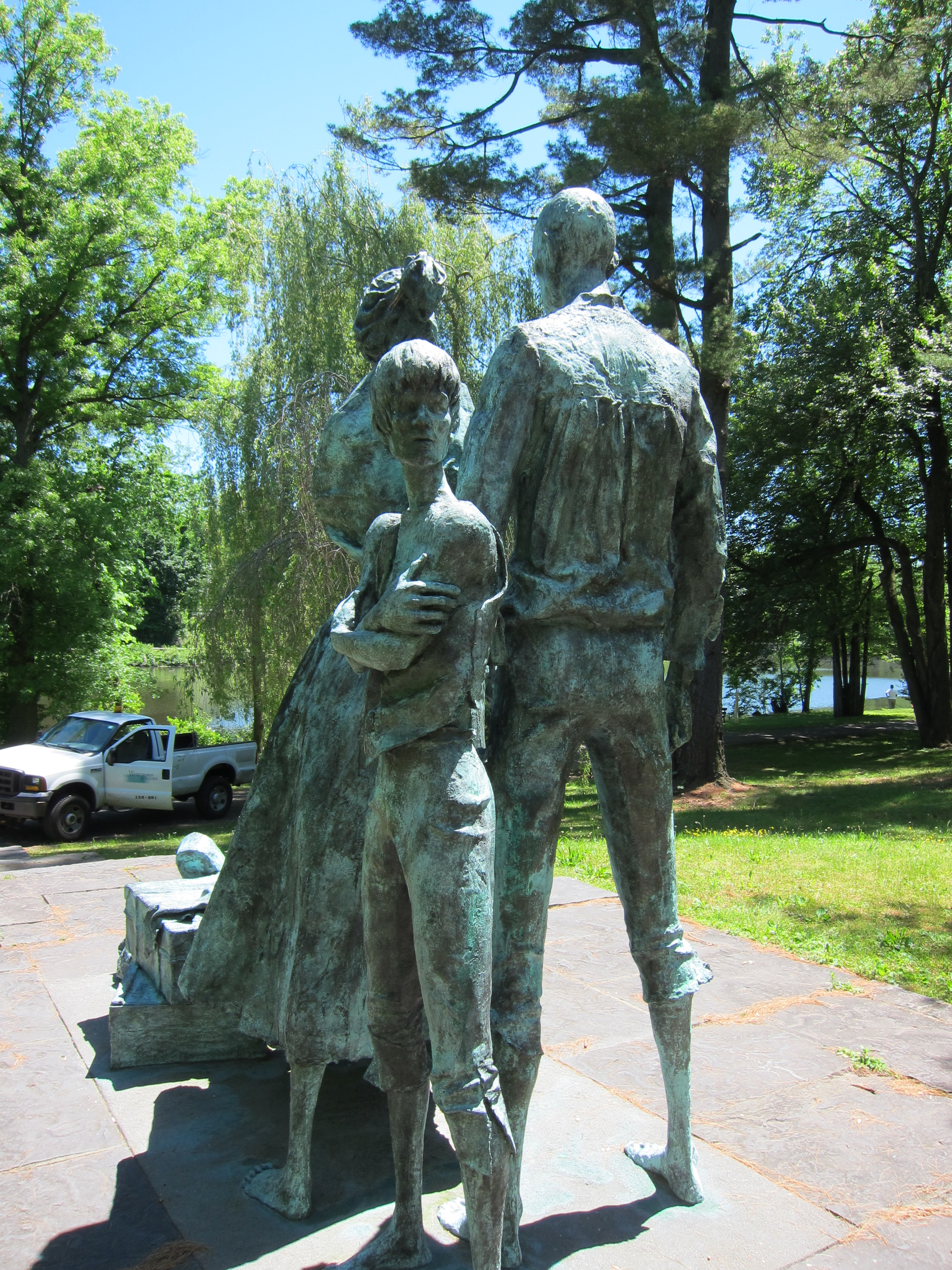

Grab one of the benches near the lake and stretch your legs. You will have a fresh appreciation for the food in your backpack.

When sufficiently rested, hop back on your whip and eat up the last 2.5 miles of trail to Elmsford.

Terminus of the South County Trail in Elmsford.
According to Wikipedia, the village of Elmsford is the terminus for both the South and North County trails. The confusing part is that there seems to be signs for the South County Trail even after Elmsford, and signs for the North County Trail don’t begin until much further north. To be honest, I’m not 100% clear on the geographical boundaries of the northern portion of the trail. But the southern portion does end in Elmsford and you’ll have to navigate through the village in order to reconnect with the upper part of the trail that leads towards Tarrytown and destinations further north.
But more importantly, Elmsford is also home to the Captain Lawrence Brewing Company. So, let’s check it out.

It’s important to note the hours of the tasting room if you want to include the brewery as a stop on your ride. They’re closed on Mondays and Tuesdays and tours are offered on Saturday afternoons, if you’re into brewery tours. Below are the full hours of the Captain Lawrence Brewery:

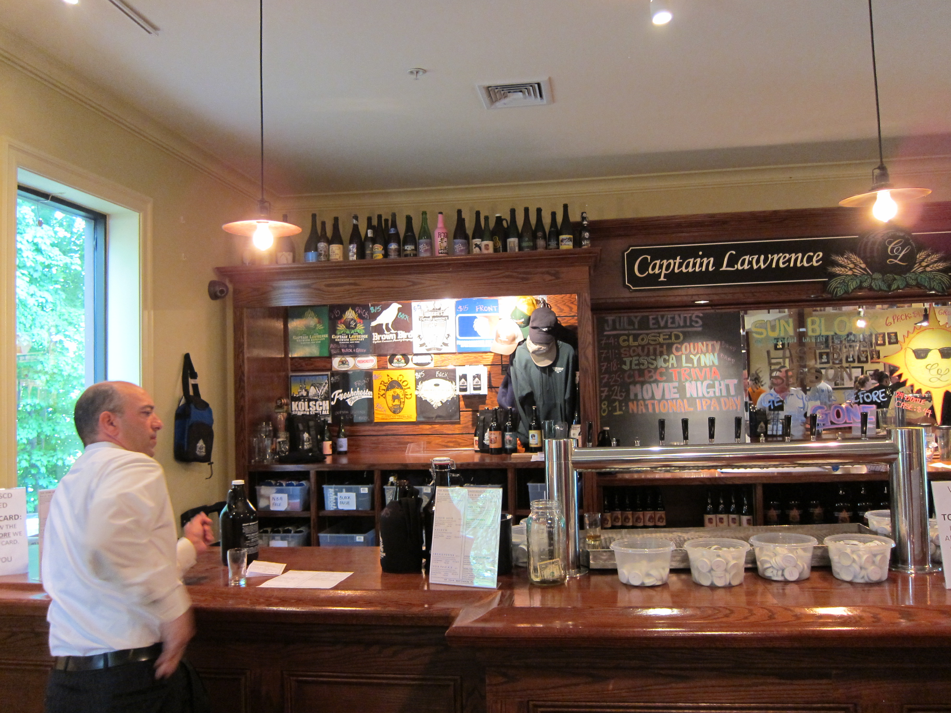
The Captain Lawrence Brewing Company
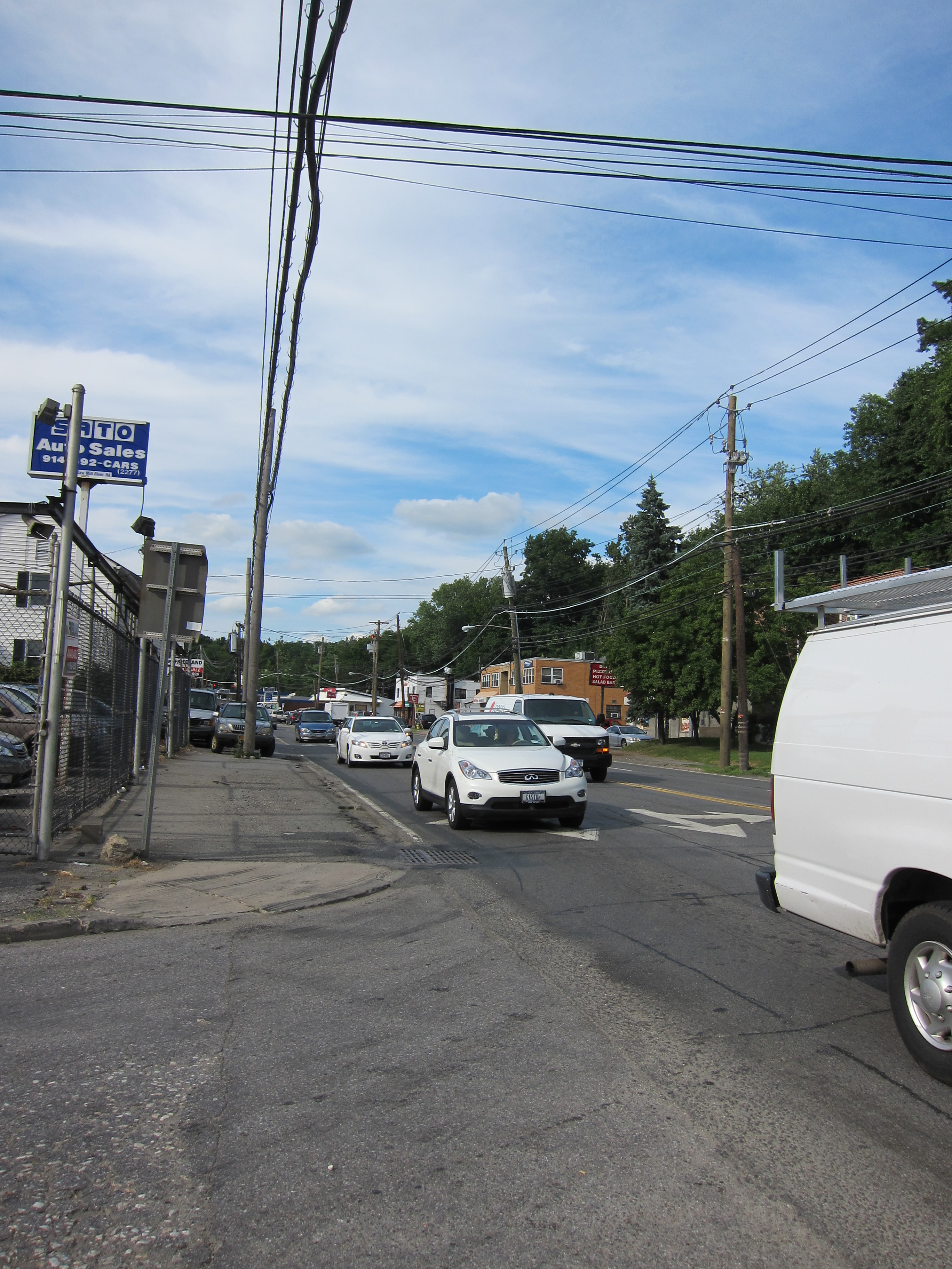
Once you reach the end of the South County Trail, you’ll spill out onto the busy intersection of Route 119/E. Main Street & N. Central Ave/Saw Mill River Road. The address of the Captain Lawrence Brewery is 444 Saw Mill River Road, so you could theoretically just take this directly to the brewery. But Saw Mill River is a fairly busy thoroughfare with lots of traffic, so its best to avoid it on a bike as much as possible.
Directly in front of you, across E. Main Street, is the Elmsford Deli. This is a good place to stop for a beverage or for one of their famous hot or cold “wedges”, apparently uber-specific Elmsford local dialect for “hoagie”.

The best way to get to the brewery while avoiding Saw Mill River Road is to start on the service road that runs along side it. This road is called –
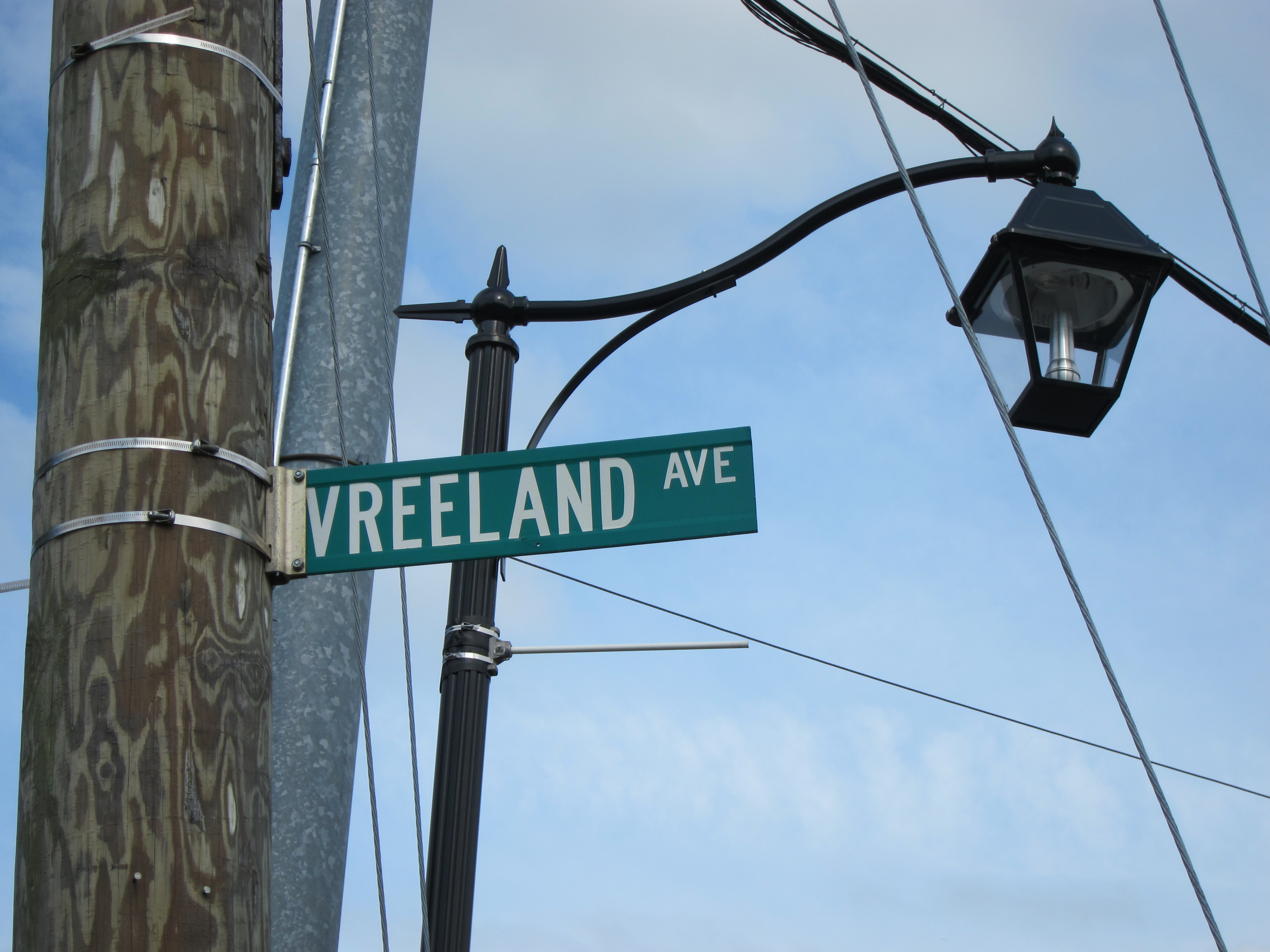
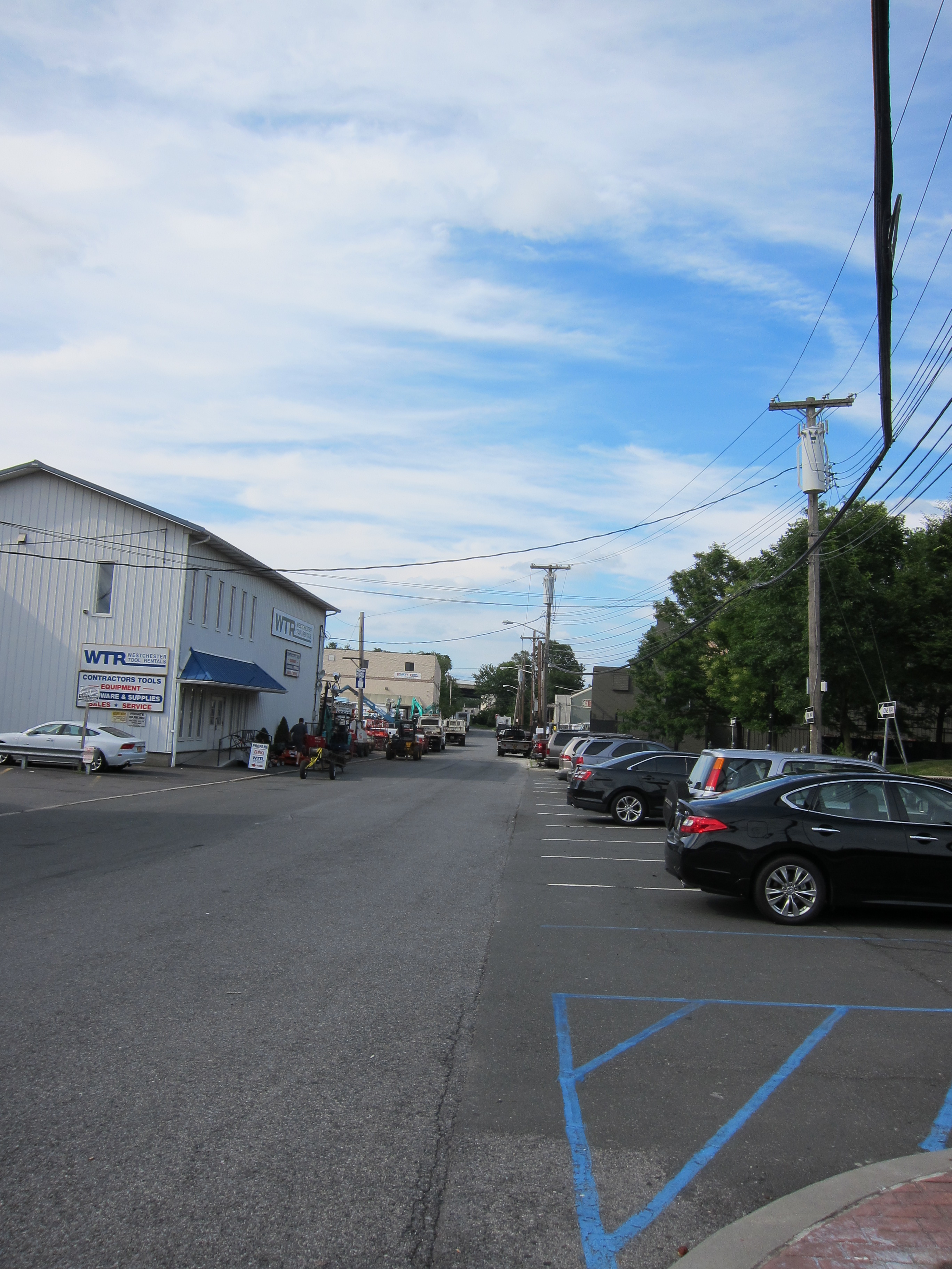
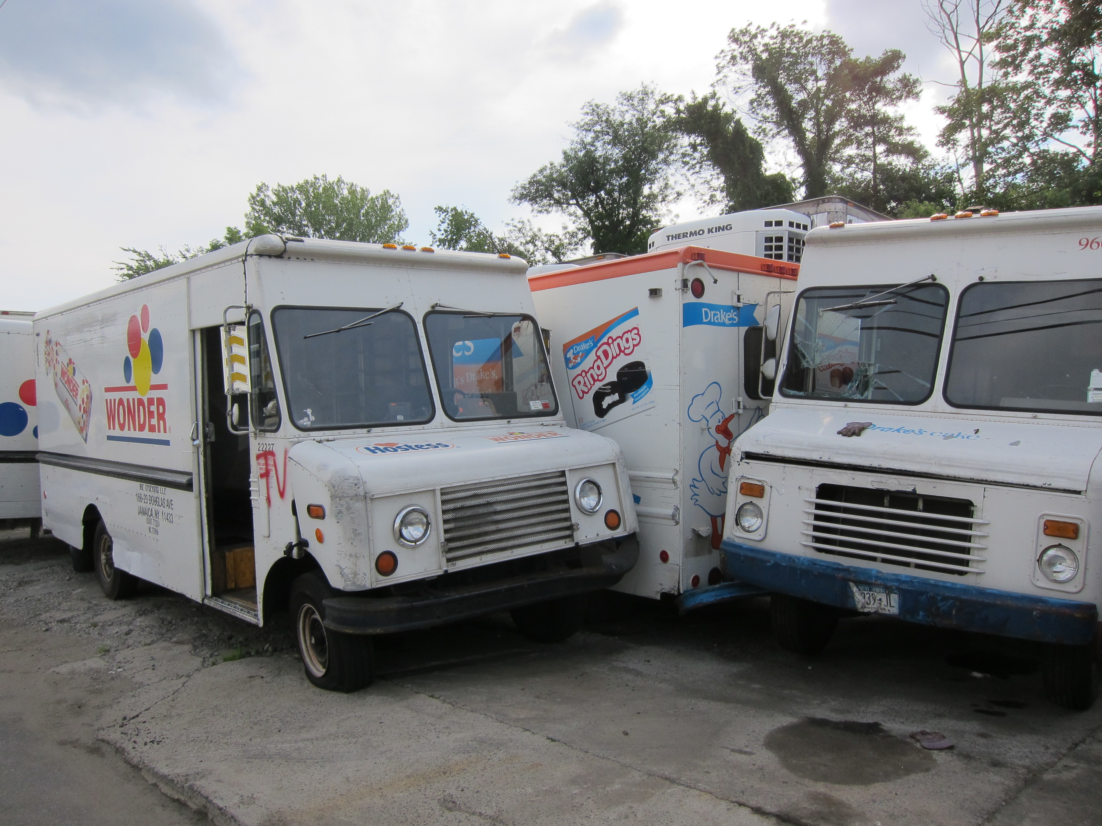
Vreeland Ave runs more or less parallel to Saw Mill River Road and ducks underneath the Cross Westchester Expressway where it changes its name to Hayes Street. This section of Elmsford is a kind of industrial wasteland, marked by a haphazard collection of junk yards, scrap iron heaps, and a morgue for decommissioned Hostess and Drake’s Cakes trucks.


At the end of Hayes Street, your only option is to turn right at the C&F Iron Works yard.

The name of this street is –

– and will lead you back to Saw Mill River Road. Unfortunately, this is the only option from here. Merge carefully into traffic and turn left on Saw Mill River Road.
Intersection of N. Payne & Saw Mill River Road
Shortly after taking this left-hand turn, you’ll hit a traffic light. Warehouse Lane is on your left and a Carvel Bakery is on your right. Take mental note of this intersection as you’ll be turning onto Warehouse Lane later in order to find the beginning of the North County Trail.
It’s about a 1/2 mile climb up Saw Mill RIver Road to the brewery. With a 45-mph speed limit and no real shoulder for bicycles, the road can feel busy. When available, try riding through the business parking lots to shave some of the distance you have to travel on Saw Mill River.
Pass the Sam’s Club on your left and keep an eye out on the right for the Cross Westchester Executive Park and a large sign with the address “444”.


Pull into the lot of the executive park and follow signs for Captain Lawrence parking to the right and around back.

You’ll see a bunch of palates and barrels –
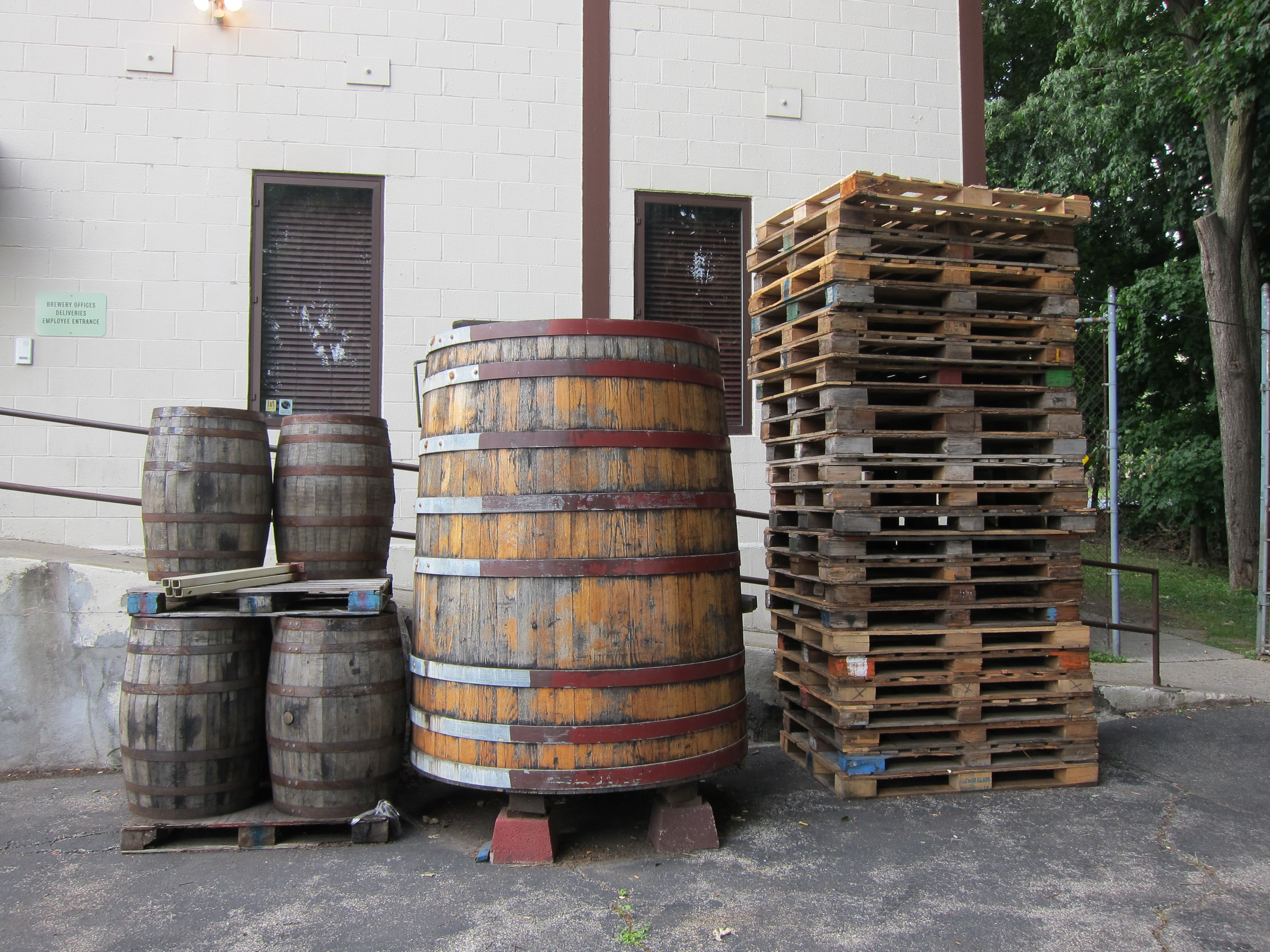
– and maybe a large tank –

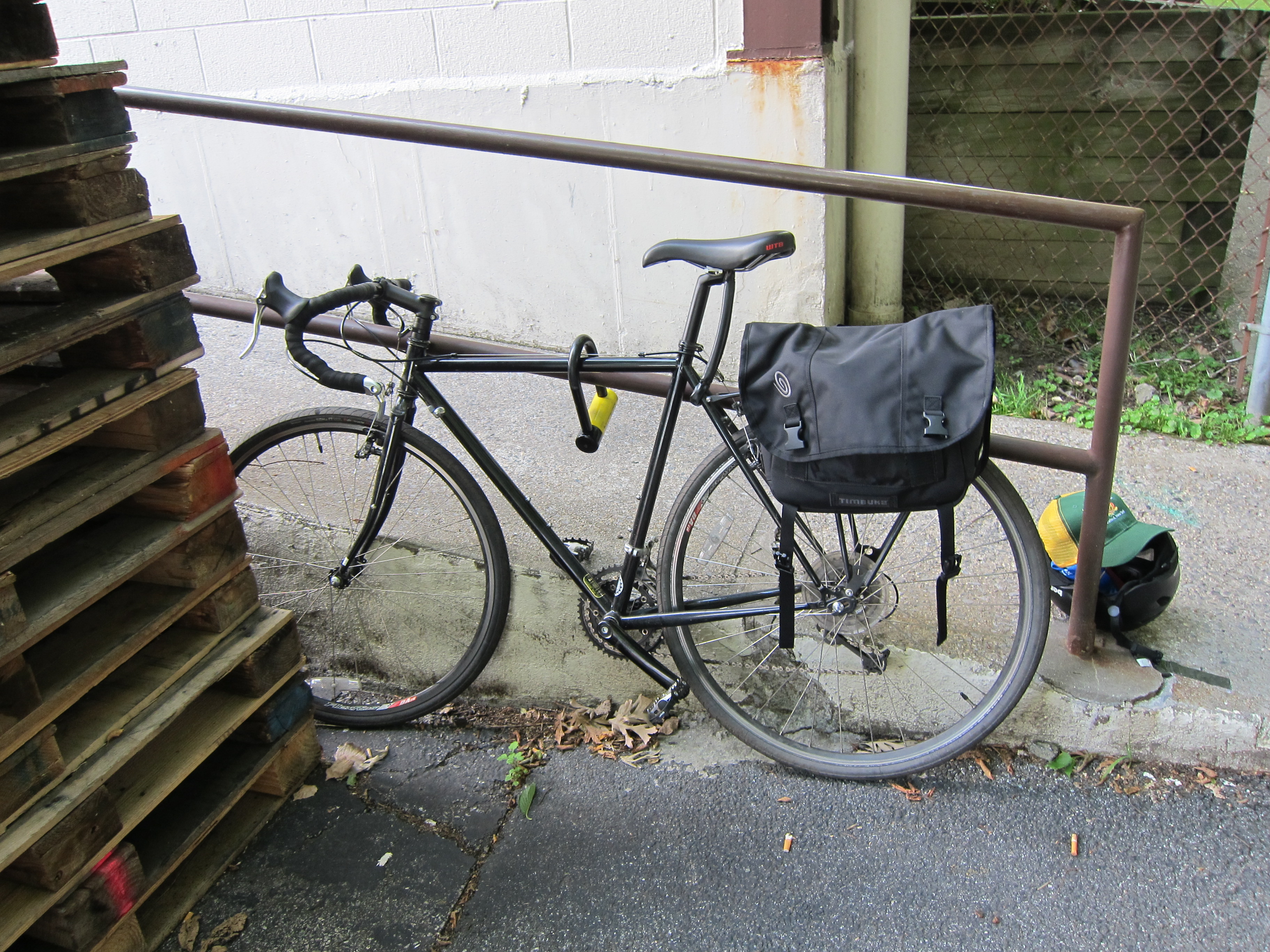
– but unfortunately, no great place to lock up your bike. I did a loop around the facility and the best I came up with was this hand rail behind a stack of palates that runs up the loading ramp.
Follow the path that goes behind the building –

– and you’ll come across the Captain Lawrence beer garden.

Enter the tasting room to your left –

– and purchase your chips from the table in front.

The way that the tasting room works is this:
You have the option of either buying 12oz cups of beer from the bar; or if you’d like to sample a bunch of different kinds of beers, you can purchase chips.

It costs $2 for a small sampling glass and $5 for 5 chips or $10 for 12 chips. The chips do not expire, so if you don’t end up using them all it’s okay. You can save them for your next visit.
I bought five chips and sampled a few beers including the coffee-charged Smoked Porter and the deliciously hoppy Matt The R.I.P.A. The tasting room is spacious and conveniently designed with the bar at one end and a drinking area off to the side.

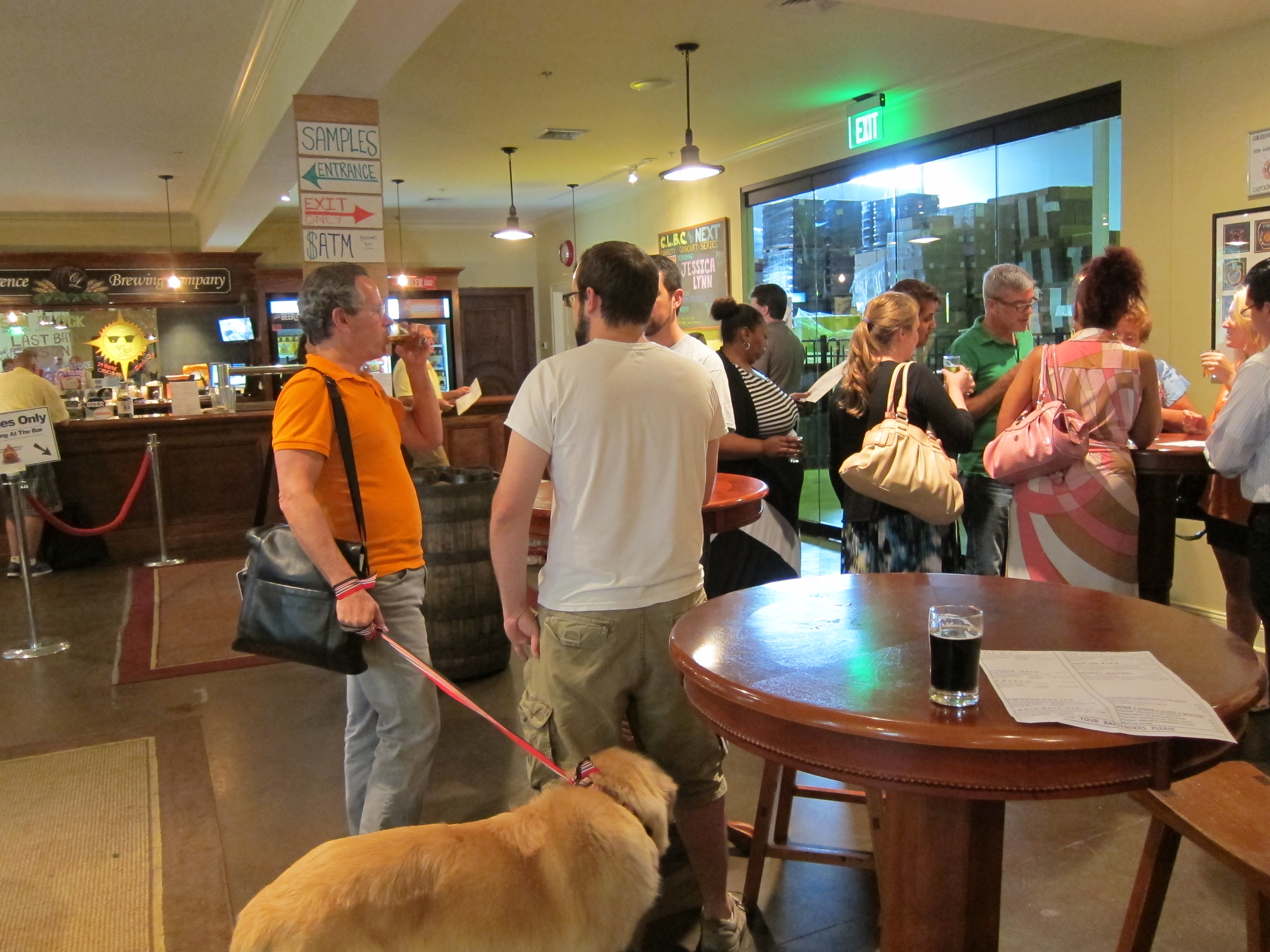
There is also a glass partition that allows you to see into the brewing lab on the other side of the tasting room.
There are a few table tops and bar stools scattered around the drinking area, but most people stood drinking and chatting casually. The walls are decorated with various best beer awards and newspaper clippings commending the success of the small brewery and its owner and master brewer, Scott Vaccaro.

There’s also a fridge where you can buy sixers of beer to go and a merchandise counter if you’re interested in hats, hoodies, t-shirts or other CLBC paraphernalia. I’m not typically a huge fan of showing the world which beers I drink… but their gear is pretty slick… so I bought a hat. Okay. And a t-shirt. But they threw in a stack of free chips, so I think I got a good deal.
After having a few samples, I decided to buy a 12oz cup of my favorite beer in the whole world – Captain Lawrence’s Freshchester Pale Ale – and retire with my drink to the beer garden. Outside, the beer garden boasts a number of benches and umbrella-shaded tables where people can enjoy their beer under the summer sun.

And if you like a game with your beer, there’s a Cornhole court off to the side of the garden, which looks as if it could also double as a Bocce Ball court.

The brewery doesn’t have a kitchen, but they’ve teamed up with an “artisanal” hot dog guy from Tarrytown called Village Dog.

I know what you’re thinking. Artisanal hot dogs belong in a Portlandia skit, not a brewery. You are wrong. Village Dog takes the “anal” out of artisanal and out of hot dogs. At first I was skeptical about spending $8 on a hot dog, but I’ve never had hot dog toppings to choose from like mac-n-cheese, lamb merguez, or tzatziki. I shelled out $7.25 for the Seoul Dog – a plump length of pork nestled inside a toasted, crispy and chewy rustic roll, smothered in kimchi and plum ketchup. I don’t know if it was the 35 miles I had ridden, or perhaps the beer I had just drank, but it was probably the best fucking hot dog I’ve ever had in my life. Take a gander:

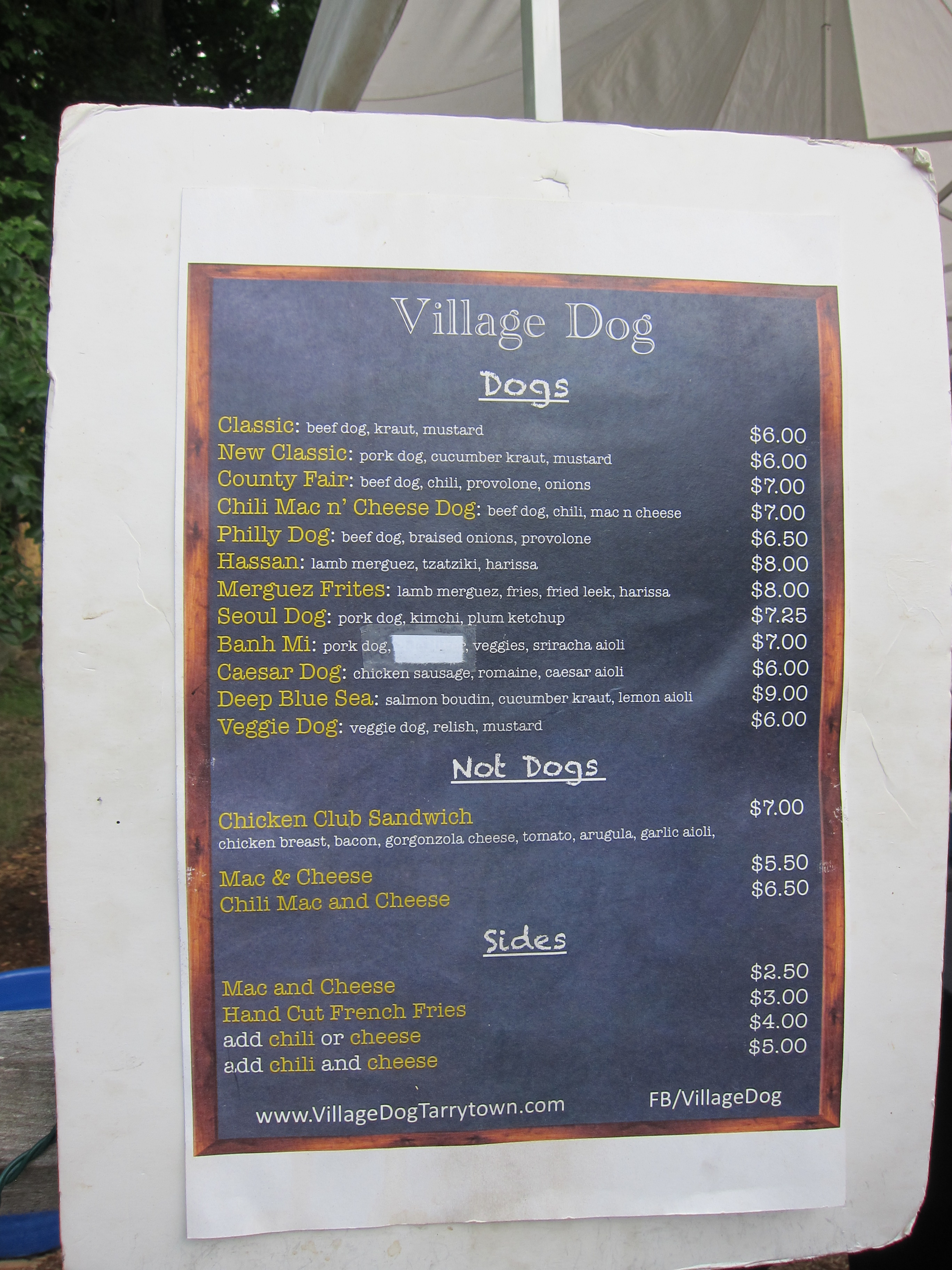
Village Dog menu
After finishing my beer and hot dog, I decided to bid farewell to Captain Lawrence and continue to Tarrytown. Exiting the brewery back onto Saw Mill River Road, I carefully steered my bike down the hill to the traffic light and turned right onto –

You’ll pass a Sam’s Club, ride over a few speed bumps, and find the entrance to the North County Trail at the end of Warehouse Lane on your right.

Supposedly the beginning of the North County Trail
Hop on this trail for about 1.5 miles and you’ll soon come across a small car park on your left.

Immediately after the car park you’ll cross a small bridge that passes over Old Saw Mill River Road and then another bridge that crosses the Saw Mill River Parkway. After this second bridge, you’ll see a pole with an attached call box –

– and a path rising up to the left. This is the path that will take you towards Tarrytown.

Straight ahead lies the North County Trail. And two naked men running towards you.

Continuing on this trail will propel you further north and all the way to Brewster if you so desire. But we’ve had too much beer to drink. So let’s take a left up this path and head to Tarrytown.
This short path climbs up a small hill and then down, emerging onto Neperan Road which skirts along the northern side of the Tarrytown Reservoir. Cross the road towards the low, gray-brick building and find the path on the left-side of said building. This path offers a peaceful alternative to Neperan Road and hugs the southern rim of the Tarrytown Reservoir.
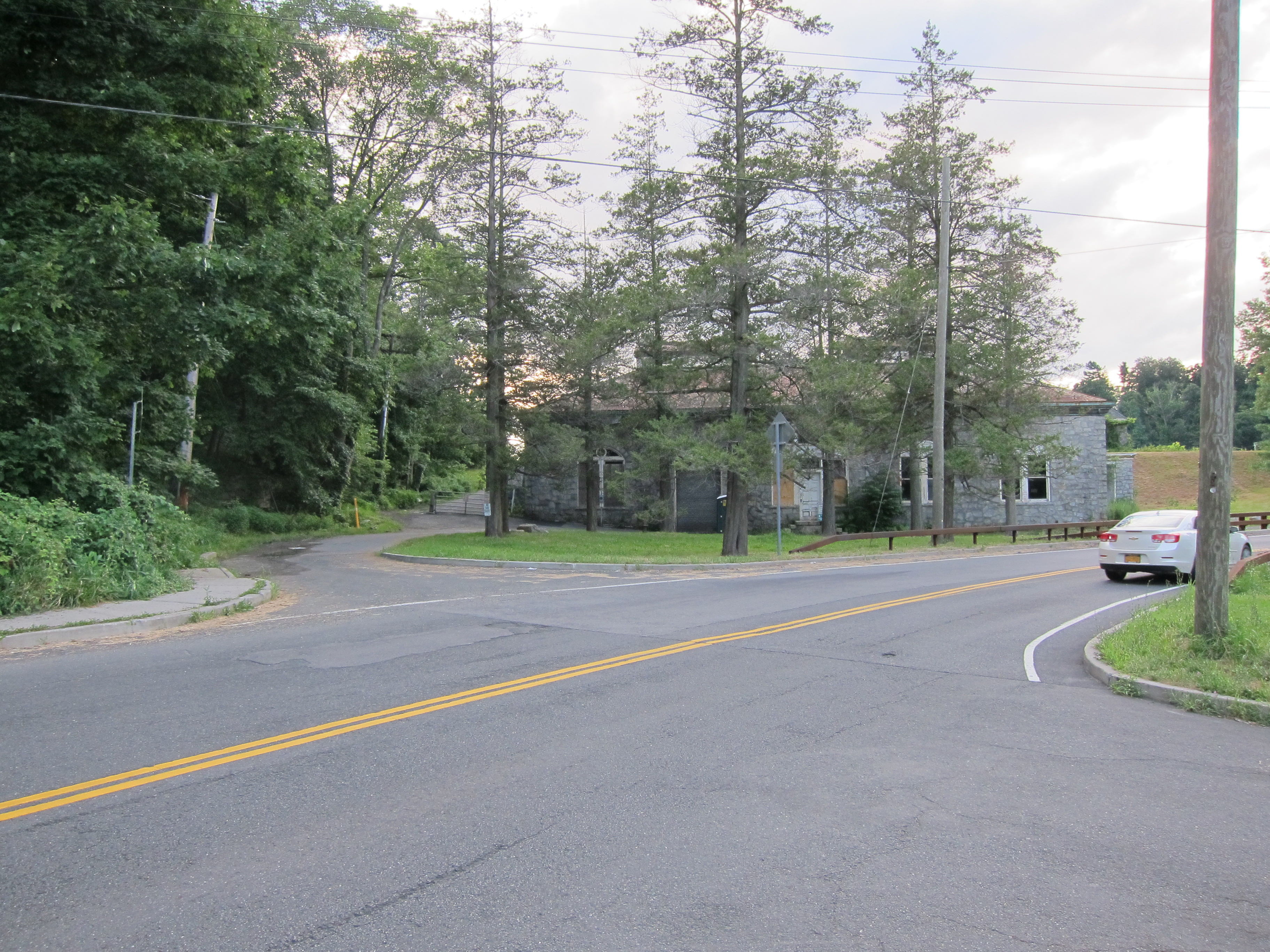

This path is flat and paved and follows the perimeter of the water for roughly one mile before rejoining Neperan Road at the western seal of the reservoir. The path will come to an end at the intersection of:

Follow Neperan up the hill to your left –

Neperan Road
– and bear left at the first fork, following signs for Route 9.

From here Neperan Road sweeps down a steep hill into the center of Tarrytown, taking you back, full circle, to Broadway, which you last left behind in The Bronx.

Neperan Road

Broadway as it appears in Tarrytown.
As Nerperan Road crosses Broadway it becomes the shop and restaurant-lined Main Street, continuing downhill towards Tarrytown Station and the river.
If you’re still feeling peckish after your hot dog or don’t feel like getting on the train just yet, there are plenty of options. On the corner of Broadway & Main Street sits Lefteris Gyro offering up Greek cuisine in an al fresco setting. Grab a table out front and people watch over a plate of spanakopita.
You are also in striking distance of Sleepy Hollow and the famous Sleepy Hollow Cemetery. Previously known as North Tarrytown until its residents voted to change the name in 1996, the village of Sleepy Hollow lies just to the north of Tarrytown Station. The cemetery, well-known for housing the burial place of “The Legend of Sleepy Hollow” author Washington Irving, is easily accessible from Broadway.
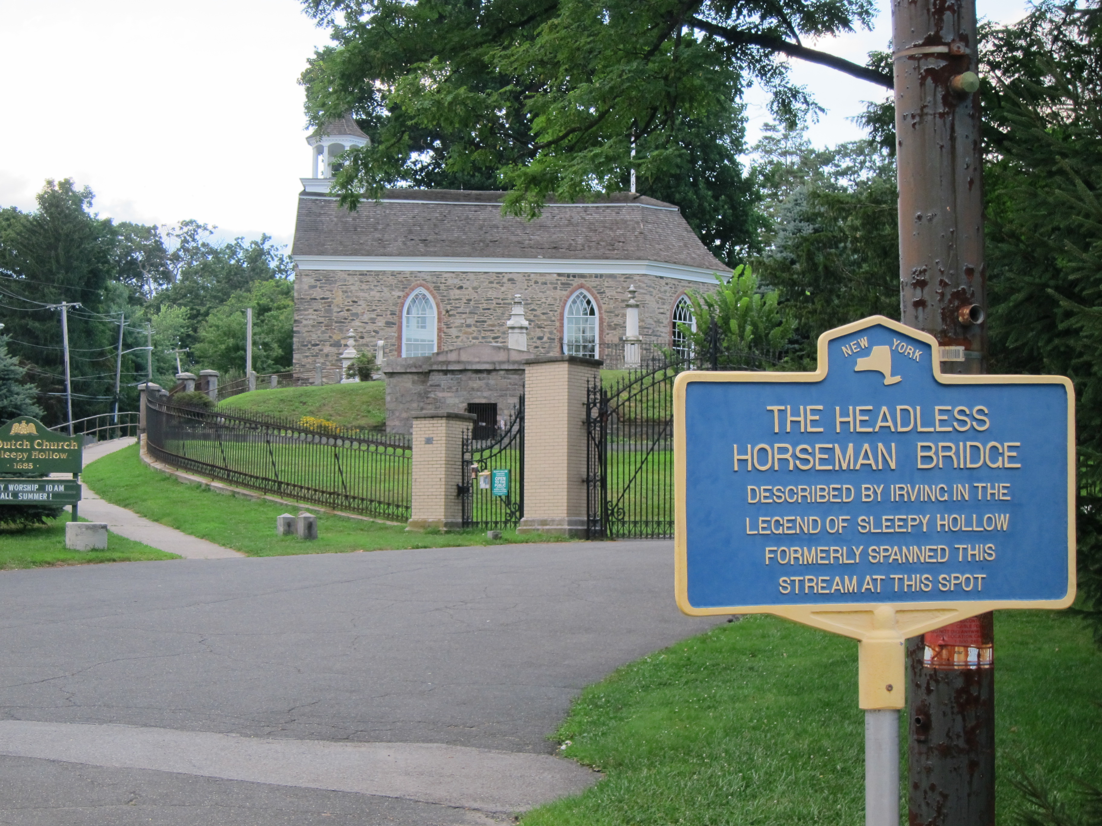
Entrance to Sleepy Hollow Cemetery.
The only problem is the limited visiting hours –

Due to the fact that the cemetery grounds close at 4:30PM, you will most likely not be able to fit both the Captain Lawrence Brewery and Sleepy Hollow Cemetery into your itinerary if you choose to go on a weekday. The weekend, on the other hand, you may be able to squeeze in both.
Just up the road from the cemetery, back in the direction of Tarrytown, is the Philipsburg Manor House.

Considered a National Historic Landmark, the house is operated as a non-profit museum by the Historic Hudson Valley. Tours are seasonal and limited during the week. An admission fee is also charged. But if you happen to be there at the right time and have 75 minutes to spare, you can learn about the Philipses – a family of Dutch assholes who got unbelievably wealthy exploiting the Atlantic slave trade and later sided with the British during the American Revolution.
Back towards Tarrytown Station, yet still technically in Sleepy Hollow, Hollywood North Pizza on Beekman Ave serves up a great slice if you’re in the mood for something quick and inexpensive. The owner Benny is hilarious. Just don’t ask him any stupid questions. Like if he serves pizza. Capiche?
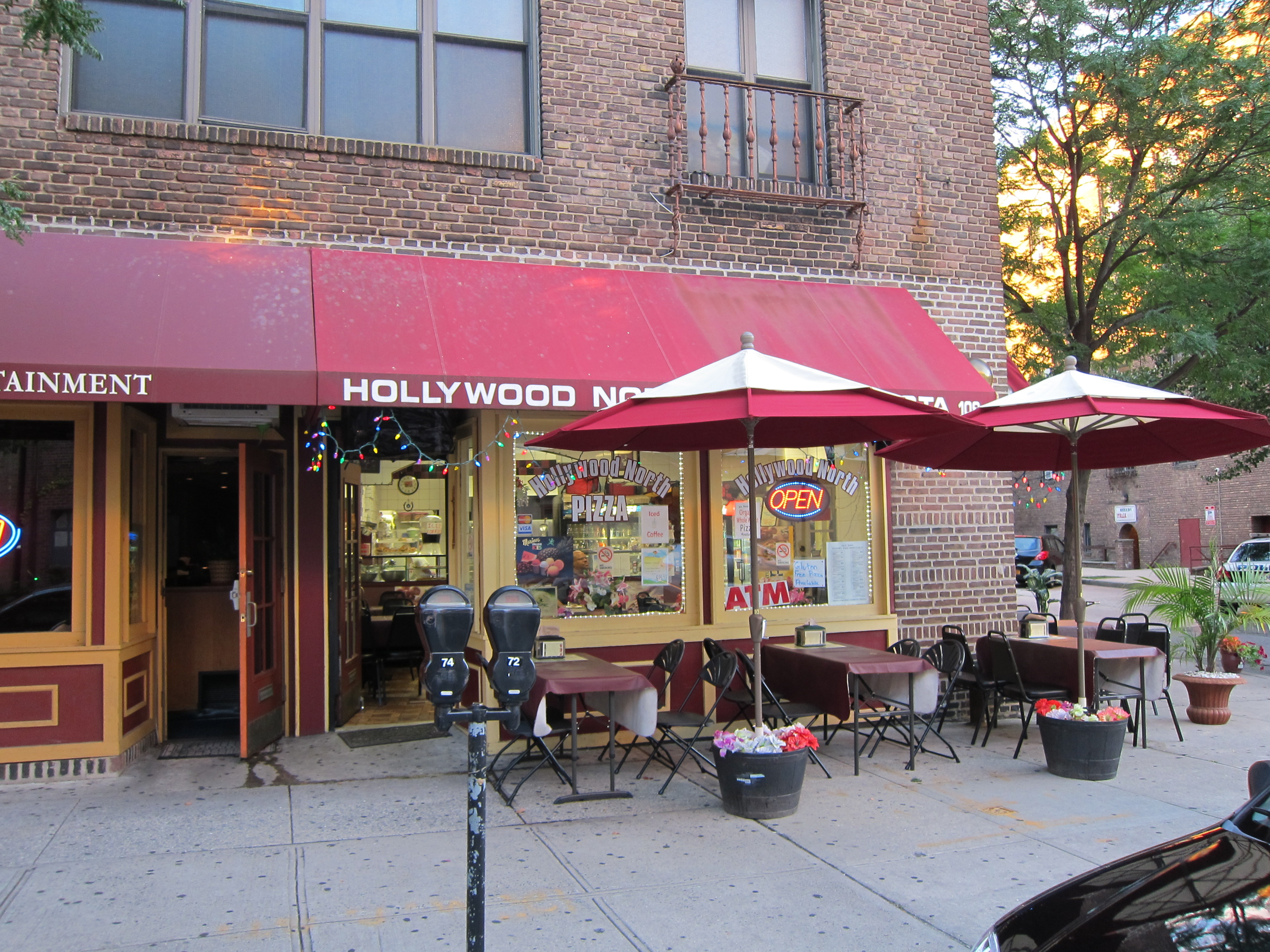

Chicken bacon ranch.
And if you just missed your train or otherwise have time to kill and are looking for a drink – you can take a short stroll down Beekman to The Huddle, a no-frills sports bar with friendly staff.

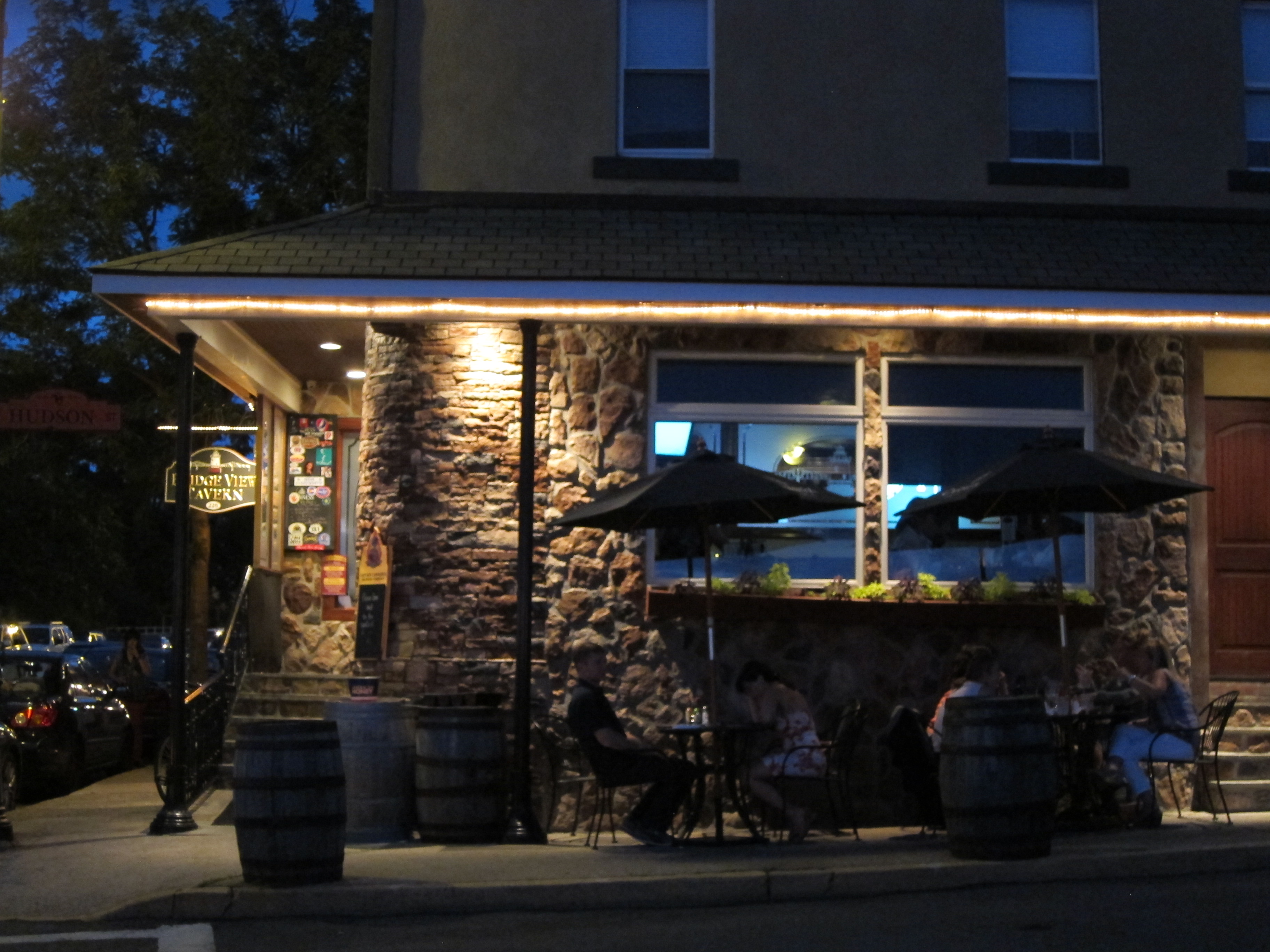
Or, my personal recommendation – Bridge View Tavern.

Located on top of the hill at the end of Beekman Avenue, Bridge View Tavern is a stone’s throw from Tarrytown Station and offers spectacular views of the Hudson River and Tappan Zee Bridge, especially during sunset.

The bar is attached to the restaurant and serves up standard pub fare in a casual atmosphere.


The BVT burger.
But if you can score one of the tables outside, you’ll be sitting pretty.
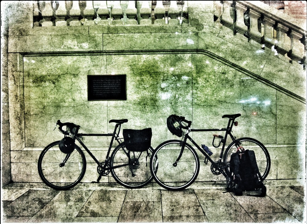
When you’re ready to roll, it’s just a 60-second bike ride down the hill to the station. Make sure you have your MTA bike permit and hop on a New York-bound train. Direct trains run frequently and the trip to Grand Central Terminal should only take about 45 minutes. With any luck the Yankees are on the road and you get a quiet train.
Relax and enjoy the ride. You’ve done well. Next time we shall go further.
As always – any questions, comments, or updates to share please feel free to leave a comment below or contact me at asurlygentleman@gmail.com. On Twitter @escapebklyn. Keep on rolling.
